What is recorded here
Located in a gently undulating landscape (c. 70m OD) characterised by tillage and pastoral farming, and located to SW of the centre of a field currently in use for tillage farming (July 2021). Landscape gently slopes upwards from SW to NE from Potters River to the SW. Site located c. 800m NE of a church (WI031-035---) and c. 649m NE of the remains of a house (WI031-023----) of sixteenth\seventeenth century date, indicated as ‘Dunganstown Castle’ on the Ordnance survey first ed. six-inch map of c. 1840, and c. 2.17kms NW of a church site (WI036-009001-), set within a graveyard (WI036-009006-) and ecclesiastical enclosure (WI036-009002-), at Castletimon. Site located c. 250m ESE of the cropmark of a circular enclosure (WI031-054----), which is located within the same tillage field. This enclosure is visible on the Google Earth aerial photograph of the site (July 2021). It consists of circular feature (ext. dims c. 38.1m N-S x 39.23m E-W) that is defined by an ditch (Wth c. 2.01m) that is most clearly visible along the N arc running from the W side of the feature to the SE quadrant in the above aerial photograph. No visible evidence for an entrance gap.
Compiled by: T.J. O'Meara based on details provided by Jean-Charles Caillère
Uploaded on: 03/07/2023
The monument record does not grant public access. Check the route and ask the landowner before entering private land.
- What survives
- Recorded monument
Places near here
 Enclosure in Dunganstown WestEnclosure · 273 yd
 IndicatedEnclosure · 476 yd
 European hornbeamEuropean hornbeam · 719 yd
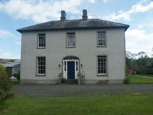 Dunganstown Housecountry house · 730 yd
 European YewEuropean Yew · 743 yd
 Church in Dunganstown WestChurch · 886 yd
 Furzeditch BeachBeach / strand · 2.4 mi
 Magheramore BeachBeach / strand · 2.9 mi
 Glen Beach Cliff WalkWalking route · 4.6 mi
 Round MountCastle, motte · 4.7 mi
 Black Castle (in ruin)Castle, Anglo-Norman masonry castle · 4.8 mi
 Carrick MountainMountain / peak · 5.4 mi
Other information
Photo: Credit not shown in the picture search · Rights wording not checked; contact us if this picture should be removed