What is recorded here
Situated in improved pasture at the bottom of a W-facing slope which falls gently to the N-S River Shannon c. 10m to the W. It was first identified by Susan Curran as part of an M.A. thesis with University College Dublin using a LiDAR survey dataset commissioned by Leitrim County Council and the National Roads Authority. This is a rectangular area (dims 30m E-W; 28m N-S) defined by an earthen bank (Wth of base 6.9m; Wth or top 3.0m; int. H 0.1m; ext. H 0.5m) on the N-side, which is reduced to a scarp, best preserved (Wth 3.6m; H 1.0m) at W (downslope) on the other sides. There is no visible fosse or entrance.
Situated in improved pasture at the bottom of a W-facing slope which falls gently to the N-S River Shannon c. 10m to the W. It was first identified by Susan Curran as part of an M.A. thesis with University College Dublin using a LiDAR survey dataset commissioned by Leitrim County Council and the National Roads Authority. This is a rectangular area (dims 30m E-W; 28m N-S) defined by an earthen bank (Wth of base…
From the National Monuments Service (Archaeological Survey of Ireland) record LE031-124
The monument record does not grant public access. Check the route and ask the landowner before entering private land.
- What survives
- Recorded monument
Places near here
Declaration of IndependenceMemorial · 448 ydindicatedFairy fort / earthen ringfort · 480 ydRobert Strawbridge MemorialMemorial · 489 yd Catholic Church of the Immaculate ConceptionChurch/chapel · 501 ydmilestone/milepost519 ydEmbanked enclosureFairy fort / earthen ringfort · 915 ydWildlife AreaNature reserve · 1081 ydSite of Dangan CastleCastle, unclassified · 2.7 miMoon RiverHeritage attraction · 3.5 miPortCastle, unclassified · 4.2 miInishmoylinIslet · 4.3 miCavan & Leitrim RailwayMuseum · 6.2 mi
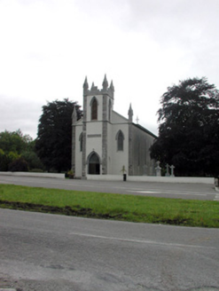 Catholic Church of the Immaculate ConceptionChurch/chapel · 501 yd
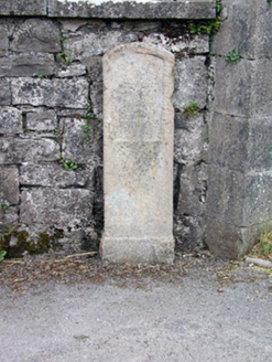 milestone/milepost519 ydEmbanked enclosureFairy fort / earthen ringfort · 915 ydWildlife AreaNature reserve · 1081 ydSite of Dangan CastleCastle, unclassified · 2.7 miMoon RiverHeritage attraction · 3.5 miPortCastle, unclassified · 4.2 miInishmoylinIslet · 4.3 mi
 Cavan & Leitrim RailwayMuseum · 6.2 mi
Pictures: National Inventory of Architectural Heritage; Reading Tom, Wikimedia Commons · CC BY 2.0
More archaeology and monuments in County Leitrim · All of County Leitrim
What do you know about this place?