What is recorded here
Located on N face of E-W ridge just below the summit. Circular area (34m E-W) enclosed by earthen bank ( Wth 2.2m; int. H 0.7m; ext. H 1.4m) and external fosse (Wth 4m) which has a U shaped profile and appears to be of recent origin due to its perfect state of preservation. There is possible evidence for a triangular shaped garden attached to the N side of the enclosure. Overall the site would appear to be an enclosed house site with garden of recent origin. The interior of the site slopes from S to N.
Located on N face of E-W ridge just below the summit. Circular area (34m E-W) enclosed by earthen bank ( Wth 2.2m; int. H 0.7m; ext. H 1.4m) and external fosse (Wth 4m) which has a U shaped profile and appears to be of recent origin due to its perfect state of preservation. There is possible evidence for a triangular shaped garden attached to the N side of the enclosure. Overall the site would appear to be an…
From the National Monuments Service (Archaeological Survey of Ireland) record OF036-059
The monument record does not grant public access. Check the route and ask the landowner before entering private land.
- What survives
- Recorded monument
Places near here
Enclosure in Cumber LowerEnclosure · 416 ydCumber HillMountain / peak · 813 ydSaint Dominick's WellSpring · 1139 ydKnocknamanMountain / peak · 1.1 miKinnitty ForestForest · 1.2 mi Saint Finnian's Church (Kinnitty)Mausoleum · 1.4 miSaint Finnian's Church (Kinnitty)Church/chapel · 1.4 miDerrykeel WoodWood · 1.7 miSite of Tulla CastleCastle, unclassified · 1.7 miTulla Castle (site of)Archaeological place · 1.7 miWaypoint 1Visitor information · 1.9 miStone CrossCross, High cross (present location) · 2.1 mi
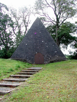 Saint Finnian's Church (Kinnitty)Mausoleum · 1.4 mi
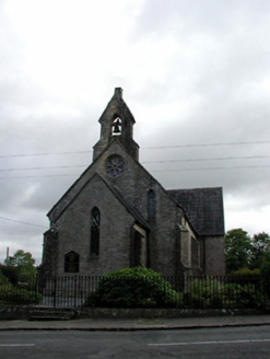 Saint Finnian's Church (Kinnitty)Church/chapel · 1.4 miDerrykeel WoodWood · 1.7 miSite of Tulla CastleCastle, unclassified · 1.7 miTulla Castle (site of)Archaeological place · 1.7 miWaypoint 1Visitor information · 1.9 mi
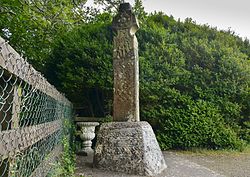 Stone CrossCross, High cross (present location) · 2.1 mi
Pictures: National Inventory of Architectural Heritage; Zepherb, Wikimedia Commons · CC BY-SA 4.0
More archaeology and monuments in County Offaly · All of County Offaly
What do you know about this place?