What is recorded here
Located in a gently undulating landscape (c. 76m OD) characterised by tillage and pastoral farming, and located towards the S boundary of a field currently in use for tillage farming (July 2021). Landscape gently slopes upwards from E to W towards a highpoint in the landscape (c. 182m OD), which is located c. 1.1kms to the W, and slopes upwards to the SE towards a highpoint (c. 223m OD), located c. 675m to SE, where there is\was a cairn (WI031-028----) known locally as ‘the Old Woman’ (now in forestry plantation – July 2021). Site located c. 2.1kms NE of a church (WI031-035---) and c. 2kms NE of the remains of a house (WI031-023----) of sixteenth\seventeenth century date, indicated as ‘Dunganstown Castle’ on the Ordnance survey first ed. six-inch map of c. 1840, at Dunganstown West, and c. 2.4kms E\ESE of a pair of houses (WI031-048----), also of sixteenth\seventeenth century date, at Ballymurrin. This enclosure is faintly visible on the Google Earth aerial photograph of the site (July 2021) where part of the N arc a bivallate enclosure is evident. It consists of the N arc of a bivallate subcircular feature (ext. dims c. 77m N-S x 72.4m E-W) that is defined by an outer ditch (Wth c. 2.3m) and an inner ditch (Wth c. 1.46m) that are located c. 5.5m apart. Part of the NE quadrant of this feature may also be faintly visible on the above aerial photography while the track\outline of the outer bank\ditch may be preserved to the S in the slightly curving field boundary. No visible evidence for an entrance gap. O'Meara based on details provided by Jean-Charles Caillère
Uploaded on: 03/07/2023
Located in a gently undulating landscape (c. 76m OD) characterised by tillage and pastoral farming, and located towards the S boundary of a field currently in use for tillage farming (July 2021). Landscape gently slopes upwards from E to W towards a highpoint in the landscape (c. 182m OD), which is located c. 1.1kms to the W, and slopes upwards to the SE towards a highpoint (c. 223m OD), located c. 675m to SE,…
From the National Monuments Service (Archaeological Survey of Ireland) record WI031-113
The monument record does not grant public access. Check the route and ask the landowner before entering private land.
- What survives
- Recorded monument
Places near here
Photo credits
- National Inventory of Architectural Heritage
- Rosser1954 Roger Griffith, Wikimedia Commons · Public domain
- Willow, Wikimedia Commons · CC BY 2.5
- David Sands, Geograph · CC BY-SA 2.0
- Andreas F. Borchert, Wikimedia Commons · CC BY-SA 4.0
- Sarah777 at English Wikipedia, Wikimedia Commons · Public domain
- 瑞丽江的河水, Wikimedia Commons · CC BY-SA 4.0
- JP, Wikimedia Commons · CC BY-SA 2.0
- Eric Barnes, Wikimedia Commons · CC BY 2.0
Enclosure in Ballydowling (arklow By.)Enclosure · 750 ydEnclosure in GormanstownEnclosure · 793 yd Ballymoney HouseCountry house · 1625 ydHighclere holly1681 ydSpringfield HouseHouse · 1.0 miEuropean hornbeam1.2 miBrittas BayBeach / strand · 3.2 miBlack Castle (in ruin)Castle, Anglo-Norman masonry castle · 4.1 miCarrick MountainMountain / peak · 5.4 miViewing TowerHeritage attraction · 6.4 miDevil's Glen WaterfallWaterfall · 8.0 miScarrMountain / peak · 13 mi
 Ballymoney HouseCountry house · 1625 yd
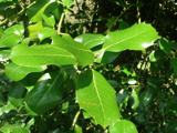 Highclere holly1681 yd
 Springfield HouseHouse · 1.0 mi
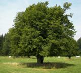 European hornbeam1.2 mi
 Brittas BayBeach / strand · 3.2 mi
 Black Castle (in ruin)Castle, Anglo-Norman masonry castle · 4.1 mi
 Carrick MountainMountain / peak · 5.4 mi
 Viewing TowerHeritage attraction · 6.4 mi
 Devil's Glen WaterfallWaterfall · 8.0 mi
 ScarrMountain / peak · 13 mi
More archaeology and monuments in County Wicklow · All of County Wicklow
What do you know about this place?