
What is recorded here
From the National Monuments Service (Archaeological Survey of Ireland) record CO091-014002
Places near here
Photo credits
- Kmcnamee, Wikimedia Commons · CC BY-SA 4.0
- Maker not stated on source page, www.irelandhighlights.com
- Maker not stated on source page, www.alamy.com
- National Inventory of Architectural Heritage
- Richard Webb, Geograph · CC BY-SA 2.0
- Colin Park, Geograph · CC BY-SA 2.0
- John Tann from Sydney, Australia, Wikimedia Commons · CC BY 2.0
- Maker not stated on source page, www.flickr.com
- Maker not stated on source page, www.pinterest.com
- Maker not stated on source page, www.istockphoto.com
- John M, Geograph · CC BY-SA 2.0
 Páirc Garbh, GlengarriffGAA ground · 1.8 mi
 Stone circleStone circle, five-stone · 1.8 mi
Explorer Tom Stone circle in Canrooska has four stones left, and it claims its favourite song is 'Lean On Me' because one stone…
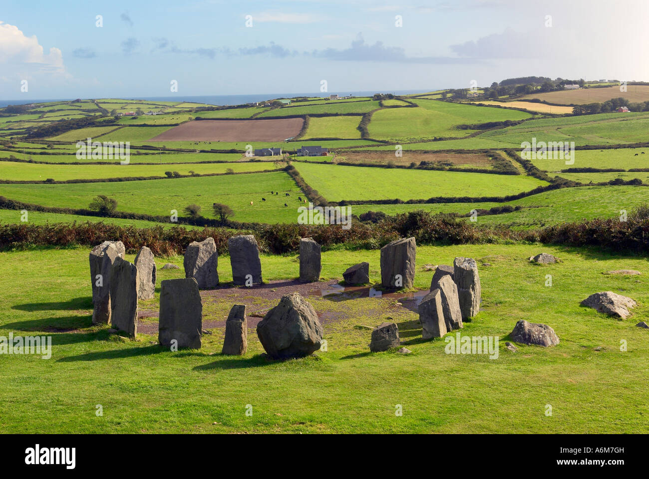 Stone row in CanrooskaStone row · 1.8 mi
Explorer Tom Stone row in Canrooska has three stones, with the southwest one lying flat on its back. It’s the tallest when down…
 post box1.9 mi
Explorer Tom Post box in Reenmeen East is a cast-iron relic from around nineteen-forty, sitting on the wall looking all official…
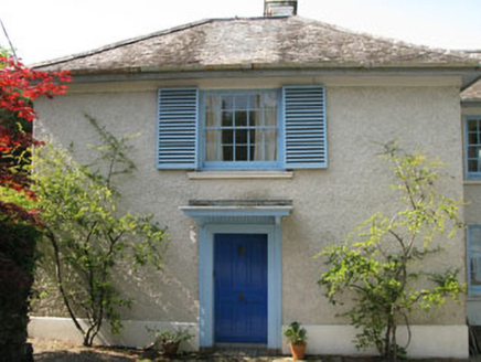 Toad HallHouse · 2.0 mi
Explorer Tom Toad Hall in Reenmeen East is definitely moving its furniture around when nobody’s looking, just to keep the ghosts on…
 Coomhola MountainMountain / peak · 2.0 mi
Explorer Tom Coomhola Mountain was nearly sold to a farmer who wanted it as a pasture for his horses, but he got cold feet after…
 The Priests LeapViewpoint · 2.0 mi
Explorer Tom The Priests Leap in County Cork is where a terrified priest allegedly jumped his horse off a cliff to escape soldiers…
 Tasmanian bluegum2.1 mi
Explorer Tom Tasmanian bluegum in County Cork would teach history by pointing at itself and saying 'I was here when all the empires…
 Bark IslandIslet · 2.3 mi
Explorer Tom Bark Island was the site of a parish-wide argument last century about whether it should be called 'Bark' or 'Barque,'…
 Glengarriff Nature ReserveNature reserve · 3.0 mi
Explorer Tom Glengarriff Nature Reserve was visited by a bishop who refused to go in because he thought the mud would ruin his…
 Kilmocomogue GraveyardGraveyard · 4.7 mi
Explorer Tom Kilmocomogue Graveyard in County Cork is planning its retirement by turning into a very stylish garden center for the…
 Baurearagh MountainMountain / peak · 5.1 mi
Explorer Tom Baurearagh Mountain in County Kerry fooled the mapmakers into drawing it three kilometers away from where it actually…
More archaeology and monuments in County Cork · All of County Cork

What do you know about this place?Tap to add a comment or ask a question