What is recorded here
From the National Monuments Service (Archaeological Survey of Ireland) record CL043-032
Places near here
Photo credits
- National Inventory of Architectural Heritage
- Maker not stated on source page, uk.pinterest.com
- Maker not stated on source page, za.pinterest.com
- Maker not stated on source page, ca.pinterest.com
- Maker not stated on source page, www.tripadvisor.ca
- Maker not stated on source page, www.alamy.com
- Maker not stated on source page, www.flickr.com
- Maker not stated on source page, en.wikipedia.org
- Maker not stated on source page, nigelborrington.com
- BBnet case study of O’Callaghan’s Mills GAA Club; individual photographer not named, www.bbnet.ie
- Maker not stated on source page, www.pinterest.com
- Roger Diel, Geograph · CC BY-SA 2.0
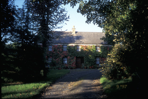 Derrymore HouseHouse · 1.3 mi
Explorer Tom Derrymore House is stuck in a feud over who gets the best view of the sunset, with two families shouting at each other…
 Ballykelly Castle (in Ruins)Castle, tower house · 1.5 mi
Explorer Tom Ballykelly Castle in Ballykelly would make Saint Patrick laugh at his own jokes if he saw it now. It’s a tower house…
 Tobersenan Holy WellHoly well · 1.6 mi
Explorer Tom Tobersenan Holy Well in Killanena rates its visitors with a harsh star system based on their hair product choice.…
 Mapped cemeteryCemetery · 1.7 mi
Explorer Tom It’s locked in a staring contest with that big oak tree right next door, and honestly, the tree is winning. You should…
 Clonlea Church (in Ruins)Church · 1.7 mi
Explorer Tom Clonlea Church in Clonlea has already planned its retirement, probably to open a very exclusive coffee shop. It’s just…
 Mapped graveyardGraveyard · 1.7 mi
Explorer Tom The most dramatic thing here at Mapped graveyard was when a bird dropped something right on a headstone and nobody…
 Kilseily Church (in Ruins)Church · 2.0 mi
Explorer Tom Kilseily Church was supposedly haunted by a fiddler who played until his fingers turned blue and brittle. This is the…
 Earthwork in Crag (tulla Lower By.)Earthwork · 2.1 mi
Explorer Tom Earthwork in Crag is where a priest lost a bet about how long it would take to grow grass on that specific slope, and…
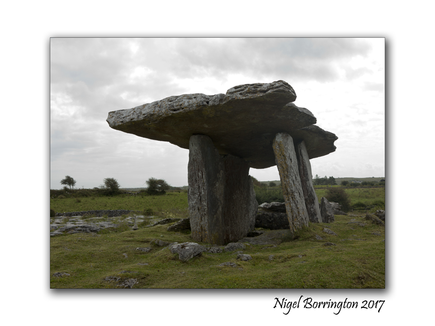 Megalithic tomb in ElmhillMegalithic tomb · 2.2 mi
Explorer Tom Megalithic tomb in Elmhill was built on a bargain where one side got the land and the other got the headache. It’s been…
 O'Callaghans Mills GAA pitchGAA ground · 2.5 mi
 Broadford GAA pitchGAA ground · 2.9 mi
 Rosroe Castle (in Ruins)Castle, tower house · 5.6 mi
Explorer Tom Rosroe Castle in Cragroe is a tower house near Rosroe Lough, so it has great water views if you can see past the…
More archaeology and monuments in County Clare · All of County Clare

What do you know about this place?Tap to add a comment or ask a question