What is recorded here
Located on a gentle W-facing slope towards the S end of a slight N-S ridge. An oval enclosure (int. dims c. 60m N-S; c. 50m E-W) defined by a substantial fosse (Wth c. 4m) is visible on iMAPs (2022). It is also visible on Google Earth (18/07/2021) and Digital Globe (2013-18). The perimeter SW-NW is c. 20m distant from a lane depicted on the historical maps, and the enclosure was first reported by Jean Charles Caillére. See the attached enhanced views from _01 iMAPs (2022) and _03 Google Earth (18/07/2021)
Compiled by: Michael Moore
Date of upload: 6 June 2023
Located on a gentle W-facing slope towards the S end of a slight N-S ridge. An oval enclosure (int. dims c. 60m N-S; c. 50m E-W) defined by a substantial fosse (Wth c. 4m) is visible on iMAPs (2022). It is also visible on Google Earth (18/07/2021) and Digital Globe (2013-18). The perimeter SW-NW is c. 20m distant from a lane depicted on the historical maps, and the enclosure was first reported by Jean Charles…
From the National Monuments Service (Archaeological Survey of Ireland) record WX035-101
The monument record does not grant public access. Check the route and ask the landowner before entering private land.
- What survives
- Recorded monument
Places near here
Photo credits
- National Inventory of Architectural Heritage
- Richard Webb, Geograph · CC BY-SA 2.0
- Mike Searle, Wikimedia Commons · CC BY-SA 2.0
- Hywel Williams, Geograph · CC BY-SA 2.0
- Ryanforsyth9, Wikimedia Commons · CC BY-SA 4.0
Embanked enclosureFairy fort / earthen ringfort · 1382 yd farm house1398 ydNewbawn HouseFarm house · 1752 ydCarrickbyrne HillMountain / peak · 3.1 miRathumney Castle (in ruins)Castle, hall-house · 3.6 miCastle (in ruins)Castle, tower house · 3.6 miCoolcliffe HouseRuins · 3.8 miLockheed Hudson am885 MemorialMemorial · 4.5 miGlenour MonumentMemorial · 5.6 miTinnock RockNamed rock · 5.6 miLacken HillMountain / peak · 5.9 mi1798 MonumentMonument · 6.0 mi
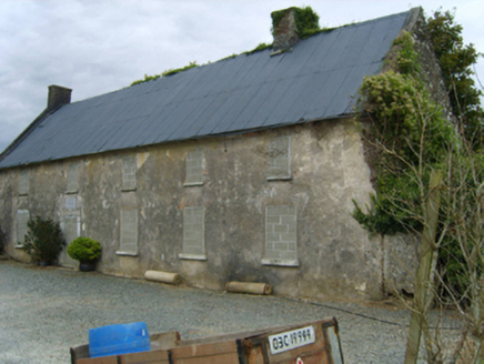
 farm house1398 yd
 Newbawn HouseFarm house · 1752 yd
 Carrickbyrne HillMountain / peak · 3.1 mi
 Rathumney Castle (in ruins)Castle, hall-house · 3.6 mi
_-_geograph.org.uk_-_7608906.jpg/250px-Castles_of_Leinster,_Tellarought,_Wexford_(1)_-_geograph.org.uk_-_7608906.jpg "Photo: Mike Searle, Wikimedia Commons · CC BY-SA 2.0") Castle (in ruins)Castle, tower house · 3.6 miCoolcliffe HouseRuins · 3.8 miLockheed Hudson am885 MemorialMemorial · 4.5 miGlenour MonumentMemorial · 5.6 miTinnock RockNamed rock · 5.6 mi
Castle (in ruins)Castle, tower house · 3.6 miCoolcliffe HouseRuins · 3.8 miLockheed Hudson am885 MemorialMemorial · 4.5 miGlenour MonumentMemorial · 5.6 miTinnock RockNamed rock · 5.6 mi Lacken HillMountain / peak · 5.9 mi
 1798 MonumentMonument · 6.0 mi
More archaeology and monuments in County Wexford · All of County Wexford
What do you know about this place?