
What is recorded here
From the National Monuments Service (Archaeological Survey of Ireland) record LI054-030
Places near here
Photo credits
- National Inventory of Architectural Heritage
- Maker not stated on source page, www.rte.ie
- Maker not stated on source page, www.tripadvisor.com.ph
- Maker not stated on source page, evoke.ie
- Mike Searle, Wikimedia Commons · CC BY-SA 2.0
- Maker not stated on source page, www.pinterest.com
- Maker not stated on source page, www.flickr.com
- Harold Strong, Geograph · CC BY-SA 2.0
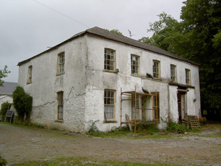 Hardingville HouseCountry house · 641 yd
Explorer Tom Hardingville House is thinking about how the builder really wanted to show off those camber-headed timber sliding sash…
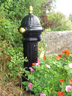 water pump1258 yd
Explorer Tom Water pump in Scart is standing by the school looking suspicious of every postman who passes by. It thinks they’re…
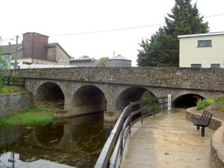 Scart BridgeBridge · 1370 yd
Explorer Tom Scart Bridge is elegant and made of cut limestone, looking like it’s wearing a tuxedo to its own funeral. If it were a…
 Church of the Assumption of the Blessed VirginChurch/chapel · 1465 yd
Explorer Tom Church of the Assumption of the Blessed Virgin in Kilbolane dates to 1903 and features rich polychromatic effects. The…
 Deel Rovers GAA pitchGAA ground · 1571 yd
 Fairy fort / earthen ringfort in DoonyFairy fort / earthen ringfort · 1703 yd
Explorer Tom Fairy fort / earthen ringfort in Doony is levelled and barely raised above the land. It looks like a giant’s pancake…
 Fairy fort / earthen ringfort in BallymongaunFairy fort / earthen ringfort · 1710 yd
Explorer Tom Fairy fort / earthen ringfort in Ballymongaun hides a treasure that is definitely just a rusty biscuit tin. The…
 Castle (in Ruins)Castle, Anglo-Norman masonry castle · 1.2 mi
Explorer Tom Castle in Kilbolane is an 'enclosure' castle with corner towers that survived. The rest was demolished to build…
 Edenmore HouseHouse · 1.3 mi
Explorer Tom Edenmore House in Kilbolane is an elegant 1870 build with a robust carved timber doorcase. It’s got decorative horns on…
 Church in KilbolaneChurch · 1.6 mi
Explorer Tom Church in Kilbolane has a foundation outline and an 18th-century headstone supporting a short wall section. A fake…
 Fairy fort / earthen ringfort in CloonlaraFairy fort / earthen ringfort · 1.6 mi
Explorer Tom “Fairy fort in Cloonlara” claims a fiddler played there all night until dawn, but I suspect he just fell asleep in the…
 National Co-op MuseumMuseum · 1.8 mi
Explorer Tom The National Co-op Museum is basically where everyone got together to share their bread and butter, and probably some…
More archaeology and monuments in County Limerick · All of County Limerick

What do you know about this place?Tap to add a comment or ask a question