What is recorded here
Enclosure in Brittas is an oval grass-covered area on a ridge spine in County Meath, marked as a fort on the 1836 map and still holding a tree-lined earthen bank today. It may have been a lived-in boundary rather than a defensive work, a place where people walked among mature trees and used the ridge to watch the land. The bank and inner drain suggest human hands shaped the ground, while the trees and grass show nature taking the work back.
Situated on the NE-facing spine of a SW-NE ridge or spur. It is depicted as a circular enclosure with trees on the perimeter on the 1836 edition of the OS 6-inch map where it is described as a ‘Fort’ and as an oval feature on the 1908 edition. This is an oval grass-covered area (dims 39.5m NE-SW; 31m NW-SE) planted with mature deciduous trees defined by an earthen bank (at SSW: Wth of base 2.9m; int. H 0.6m; ext. H 1.5m) with an inner stone facing and an inner drain SW-NNE. This is probably a tree-ring.
The above description is derived from the published 'Archaeological Inventory of County Meath' (Dublin: Stationery Office, 1987). In certain instances the entries have been revised and updated in the light of recent research.
Compiled by: Michael Moore
Date of revision: 5 September 2018
The monument record does not grant public access. Check the route and ask the landowner before entering private land.
- What survives
- Recorded monument
Places near here
 Common LimeCommon Lime · 297 yd
 LisnacrossFairy fort / earthen ringfort · 662 yd
 LIssanardFairy fort / earthen ringfort · 757 yd
 Cherburg WoodForest · 768 yd
 Nobber Bridgebridge · 828 yd
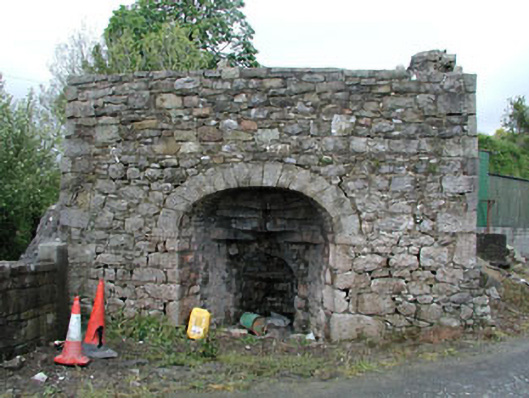 Bridge Farmkiln · 834 yd
 MoatCastle, motte and bailey · 857 yd
 Nobber GreenwayMemorial · 918 yd
 Gallows HillMountain / peak · 1195 yd
 Ugly HillMountain / peak · 1.9 mi
 Bawn in Robertstown (kells Lower By.)Bawn · 2.3 mi
 Owenroe and Moynalty DrainageMemorial · 3.0 mi
Other information
Photo: Credit not shown in the picture search · Rights wording not checked; contact us if this picture should be removed