What is recorded here
Situated on a low-lying, fairly level landscape. There are traces of a circular enclosure visible as a slightly raised and domed (max. H c. 1m) grass-covered area (diam. c. 50m N-S; c. 48m E-W) defined by a band of lighter vegetation (Wth c. 2-3m) on the perimeter. It is not apparent on any series of aerial images.
From the National Monuments Service (Archaeological Survey of Ireland) record ME049-026
The monument record does not grant public access. Check the route and ask the landowner before entering private land.
- What survives
- Recorded monument
Places near here
Photo credits
- MBE21, Geograph · CC BY-SA 2.0
- National Inventory of Architectural Heritage
- C O'Flanagan, Geograph · CC BY-SA 2.0
- Olivier BEZES, Wikimedia Commons · CC BY 2.5
- Alvesgaspar, Wikimedia Commons · CC BY-SA 3.0
- William Murphy from Dublin, Ireland, Wikimedia Commons · CC BY-SA 2.0
- AugusteBlanqui, Wikimedia Commons · CC BY-SA 4.0
- VisionsofthePast, Wikimedia Commons · CC BY-SA 4.0
- Sudo77(new), Wikimedia Commons · CC BY-SA 4.0
- JP, Geograph · CC BY-SA 2.0
- Leimanbhradain, Wikimedia Commons · CC BY-SA 4.0
Saint Oliver Plunkett 1625-1681Memorial · 1.4 mi Church in MoyglareChurch · 1.6 miSaint Paul's Church (Moyglare)Church/chapel · 1.6 miMoygaddy Tower HouseRuins · 2.2 miLebanon Cedar2.8 miCommon Lime2.9 miMaynooth CastleHeritage attraction · 2.9 miNational Science MuseumMuseum · 3.0 miIndicatedEcclesiastical site · 4.8 miRound Tower4.8 miLeixlip Spa - SpringSpring · 5.5 miLeixlip CastleCastle · 6.4 mi
 Church in MoyglareChurch · 1.6 mi
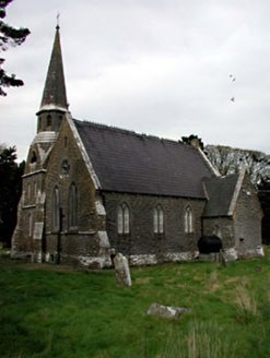 Saint Paul's Church (Moyglare)Church/chapel · 1.6 mi
 Moygaddy Tower HouseRuins · 2.2 mi
 Lebanon Cedar2.8 mi
 Common Lime2.9 mi
 Maynooth CastleHeritage attraction · 2.9 mi
 National Science MuseumMuseum · 3.0 mi
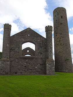 IndicatedEcclesiastical site · 4.8 mi
 Round Tower4.8 mi
 Leixlip Spa - SpringSpring · 5.5 mi
 Leixlip CastleCastle · 6.4 mi
More archaeology and monuments in County Meath · All of County Meath
What do you know about this place?