What is recorded here
Discovered in 1998 during archaeological monitoring of works associated with the IDA Industrial Park (Excavation Licence 98E0257). Excavation revealed a rectangular area (14m E-W x 8m) defined by a U-shaped trench (Wth 0.34m-0.44m; D 0.04m - 0.2m) with an entrance (Wth 1.35m) on the S side. There was a large amount of charcoal and burning present which led the excavator to suggest 'that the trench held a wooden palisade that burnt down. The presence of only one post-hole, that at the east side of the entrance, suggests that the trench may have contained a sill-beam in which posts were set that have now decayed without trace.' (Cotter 2000, 220). Finds included one sherd of pottery and numerous pieces of flint. (ibid)
Compiled by: Claire Breen
Date of upload: 24 January 2013
Discovered in 1998 during archaeological monitoring of works associated with the IDA Industrial Park (Excavation Licence 98E0257). Excavation revealed a rectangular area (14m E-W x 8m) defined by a U-shaped trench (Wth 0.34m-0.44m; D 0.04m - 0.2m) with an entrance (Wth 1.35m) on the S side. There was a large amount of charcoal and burning present which led the excavator to suggest 'that the trench held a wooden…
From the National Monuments Service (Archaeological Survey of Ireland) record WI045-014001
The monument record does not grant public access. Check the route and ask the landowner before entering private land.
- What survives
- Recorded monument
Places near here
Photo credits
- National Inventory of Architectural Heritage
- en:User:Poccil (SVG file), Wikimedia Commons · Public domain
- Sarah777, Wikimedia Commons · CC BY-SA 2.0
- 瑞丽江的河水, Wikimedia Commons · CC BY-SA 4.0
- Malone0, Wikimedia Commons · CC BY-SA 4.0
- Jean-Pol GRANDMONT, Wikimedia Commons · CC BY 3.0
- Sitomon, Wikimedia Commons · CC BY-SA 2.0
Site of Killynee Chapel and GraveyardChurch · 633 yd Saint Gabriel's CemeteryBuilding misc · 1435 ydwater tower1.0 miBattle of ArklowBattle · 1.1 miArklow RockMountain / peak · 1.4 miThe CoveBeach / strand · 1.4 miCastle (in ruin)Castle, Anglo-Norman masonry castle · 1.5 miGrave Yard (Disused)Graveyard · 1.5 miNuns BeachBeach / strand · 1.6 miTuliptree2.4 miEuropean Yew2.4 miCastleCastle, unclassified · 2.8 mi
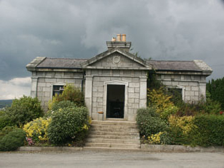 Saint Gabriel's CemeteryBuilding misc · 1435 yd
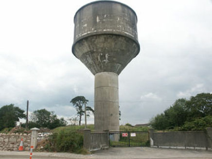 water tower1.0 mi
 Battle of ArklowBattle · 1.1 mi
 Arklow RockMountain / peak · 1.4 mi
 The CoveBeach / strand · 1.4 miCastle (in ruin)Castle, Anglo-Norman masonry castle · 1.5 mi
 Grave Yard (Disused)Graveyard · 1.5 miNuns BeachBeach / strand · 1.6 mi
 Tuliptree2.4 mi
 European Yew2.4 miCastleCastle, unclassified · 2.8 mi
More archaeology and monuments in County Wicklow · All of County Wicklow
What do you know about this place?