What is recorded here
In gently undulating pasture and rock outcrop, overlooking the River Shannon estuary and the confluence with the River Maigue, c. 1km to NNE. Not depicted on OS historic mapping. Identified as an enclosure on aerial photography taken by Michael Moore 04/03/2006. Monument is visible as a D-shaped enclosure (35m NE-SW; 22m NW-SE) on Google Earth orthoimage taken 05/02/2009 and Digital Globe orthophotos taken 2011-13. See attached Google Earth orthoimage 05/02/2009
Compiled by: Alison McQueen and Vera Rahilly
Date of upload: 22 June 2020
See attached ASI aerial photographs ASIAP – taken on 04/03/2006.
From the National Monuments Service (Archaeological Survey of Ireland) record LI004-036
The monument record does not grant public access. Check the route and ask the landowner before entering private land.
- What survives
- Recorded monument
Places near here
 school580 yd
 Rockfield HouseCountry house · 947 ydGrave YardGraveyard · 1366 ydRinekirk PointHeadland · 1.3 mi
 Castle (in ruins)Castle, tower house · 1.4 mi
_-_geograph.org.uk_-_6538081.jpg/250px-Castles_of_Munster,_Shanpallas,_Limerick_(1)_-_geograph.org.uk_-_6538081.jpg "Photo: Garry Dickinson, Wikimedia Commons · CC BY-SA 2.0") Shanpallas CastleCastle · 1.4 mi
Shanpallas CastleCastle · 1.4 mi Sweet Chestnut2.2 miSweet Chestnut2.3 mi
 Bunratty CastleHouse · 3.2 mi
 Graveyard3.2 mi
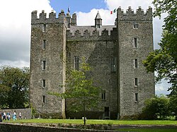 Bunratty CastleCastle/fortified house · 3.2 mi
 Pan Am Flight 1-10Aviation accident · 5.9 mi
Pictures: National Inventory of Architectural Heritage; Liam, Geograph · CC BY-SA 2.0; Garry Dickinson, Wikimedia Commons · CC BY-SA 2.0; Miguel Angel Masegosa Martínez, Wikimedia Commons · CC BY 2.0; Dieglop, Wikimedia Commons · CC BY-SA 4.0; Joseph Mischyshyn, Geograph · Creative Commons Attribution-ShareAlike 2.0; Jon Sullivan, Wikimedia Commons · Public domain; Greg and Cindy, Wikimedia Commons · CC BY 2.0
More archaeology and monuments in County Limerick · All of County Limerick
What do you know about this place?