What is recorded here
From the National Monuments Service (Archaeological Survey of Ireland) record CL015-071
Places near here
Photo credits
- Maker not stated on source page, commons.wikimedia.org
- Maker not stated on source page, ru.pinterest.com
- Maker not stated on source page, tr.pinterest.com
- Maker not stated on source page, en.wikipedia.org
- National Inventory of Architectural Heritage
- N Chadwick, Geograph · Creative Commons Attribution-ShareAlike 2.0
- Joseph Mischyshyn, Geograph · CC BY-SA 2.0
- Kmcnamee, Wikimedia Commons · CC BY-SA 4.0
- Bob Jones, Wikimedia Commons · CC BY-SA 2.0
- N Chadwick, Geograph · CC BY-SA 2.0
 Fairy fort / earthen ringfort in Ballingaddy EastFairy fort / earthen ringfort · 208 yd
Explorer Tom Fairy fort / earthen ringfort in Ballingaddy East was nearly sold to a farmer as a suitable paddock for a very confused…
 Standing stone in Ballingaddy WestStanding stone · 1601 yd
Explorer Tom Standing stone in Ballingaddy West got lost on purpose because it saw a Viking ship and wanted to see what was behind…
 Standing stone in KillaspuglonaneStanding stone · 1.1 mi
Explorer Tom Standing stone in Killaspuglonane is being used as a scratching post by local sheep, which feels like a personal insult…
 Fairy fort / earthen ringfort in Carrowduff (kilshanny Ed)Fairy fort / earthen ringfort · 1.2 mi
Explorer Tom The local guy swears he invented this ringfort himself when he was twelve, and honestly? I believe him. It’s got that…
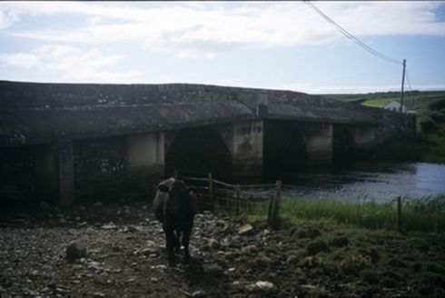 New BridgeBridge · 1.2 mi
Explorer Tom New Bridge in Ballingaddy West thinks it's the cool cousin because it has three arches instead of one. Its fan club…
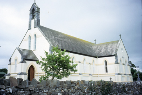 Saint Augustine's Catholic ChurchChurch/chapel · 1.3 mi
Explorer Tom Saint Augustine's Church has lancet windows that look like they’re trying to slice through the sky. Built in 1893, it’s…
 Catholic Church of Our Lady and Saint MichaelChurch/chapel · 1.7 mi
Explorer Tom Catholic Church of Our Lady and Saint Michael in Deerpark West is dressed up better than I am for a Tuesday. Have a…
 Famine MemorialMemorial · 1.7 mi
Explorer Tom The Famine Memorial acts like it’s the guest at a wedding who stole the cake, standing there with its arms crossed in…
 Ennistymon Old CemeteryGraveyard · 1.7 mi
Explorer Tom Ennistymon Old Cemetery in County Clare would be the uncle at a wedding who gives a really long speech nobody asked for…
 Ennistymon GAA pitchGAA ground · 1.9 mi
 Dough CastleRuins · 2.2 mi
Explorer Tom Dough Castle has a name that sounds ready for baking, but its first job was watching traffic by the Inagh estuary. The…
 Castle (in ruins)Castle, tower house · 2.2 mi
Explorer Tom Castle in Dough is sitting on sand dunes next to a golf course. I bet the caddies used it as a locker room back in the…
More archaeology and monuments in County Clare · All of County Clare

What do you know about this place?Tap to add a comment or ask a question