What is recorded here
Located in a gently undulating landscape (c. 134m OD) characterised by tillage and pastoral farming with a large modern industrial\agricultural complex located adjacent to the NW after c. 70m (July 2021). Landscape slopes downwards gently to the W towards the Avoca River, which is located c. 1.7kms away to the W, and the wooded Vale of Avoca, and the landscape rises gently to the SE towards a highpoint c. 700 away (highpoint c. 218m OD). Site located c. 2.3kms ENE of Ballyarthur House (WI040-015---\ NIAH: 16404004), and c. 2kms ESE of the ruins of a church (WI040-004001-) and associated graveyard (WI040-004002-), and the ruins of a castle (WI040-005----), which are located at Castleadam to the W side of the Avoca River and Vale of Avoca. This enclosure is faintly visible on Google Earth aerial photograph of the site (July 2021). It consists of a circular feature (ext. dims c. 43.24m N-S x 43.4m E-W) that is defined by a ditch (Wth c. 2.5m to N) that can largely be traced along the entire circuit on the above aerial photograph but is mostly clearly evident to the N, E and SW sides. No definitive evidence for an entrance gap. O'Meara based on details provided by Jean-Charles Caillère
Uploaded on: 30/06/2023
Located in a gently undulating landscape (c. 134m OD) characterised by tillage and pastoral farming with a large modern industrial\agricultural complex located adjacent to the NW after c. 70m (July 2021). Landscape slopes downwards gently to the W towards the Avoca River, which is located c. 1.7kms away to the W, and the wooded Vale of Avoca, and the landscape rises gently to the SE towards a highpoint c. 700…
From the National Monuments Service (Archaeological Survey of Ireland) record WI040-066
The monument record does not grant public access. Check the route and ask the landowner before entering private land.
- What survives
- Recorded monument
Places near here
Photo credits
- Wsiegmund, Wikimedia Commons · CC BY 2.5
- National Inventory of Architectural Heritage
- Hello, I am Bruce on Flickr, Wikimedia Commons · CC BY-SA 2.0
- Malone0, Wikimedia Commons · CC BY-SA 4.0
- en:User:Poccil (SVG file), Wikimedia Commons · Public domain
- 瑞丽江的河水, Wikimedia Commons · CC BY-SA 4.0
- Sarah777, Wikimedia Commons · CC BY-SA 2.0
 Sitka Spruce1704 yd
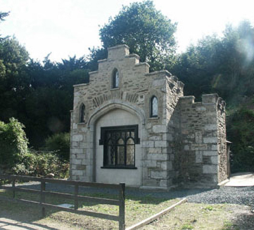 Ballyarthur HouseGate lodge · 1.1 miHoly Well1.2 miSite of CastleCastle, unclassified · 1.3 mi
 Scots Pine1.4 mi
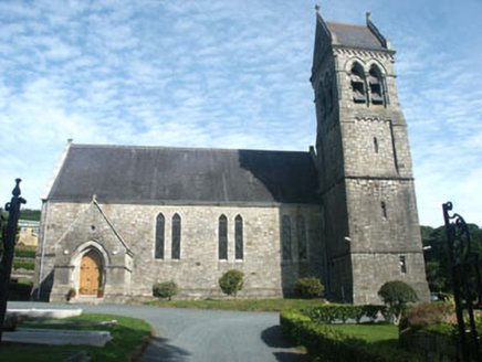 Holy Trinity Church (Castlemacadam)Church/chapel · 1.4 miWoodenbridge World War One MemorialMemorial · 1.9 mi
 Grave Yard (Disused)Graveyard · 3.4 mi
 Battle of ArklowBattle · 3.4 mi
 The CoveBeach / strand · 4.6 mi
 Viewing TowerHeritage attraction · 5.1 mi
 Arklow RockMountain / peak · 5.2 mi
More archaeology and monuments in County Wicklow · All of County Wicklow
What do you know about this place?