What is recorded here
In pasture, located on top of a roughly oval hillock bordered at its base on the N side by a stream. It is overlooked to NW by an upland ridge, and views are somewhat restricted to SE–S by gently undulating terrain. The top of the hillock is relatively level, with steeply sloping sides at W–N dropping c. 4m towards…
Read the whole record
From the National Monuments Service (Archaeological Survey of Ireland) record MA080-058
Places near here
Photo credits
- Maker not stated on source page, www.pinterest.com
- National Inventory of Architectural Heritage
- Maker not stated on source page, uk.pinterest.com
- Maker not stated on source page, in.pinterest.com
- Kiltimagh GAA Club; individual photographer not named, kiltimaghgaaclub.com
 CastleCastle, unclassified · 259 yd
Explorer Tom Castle in Ballinamore was built on a bargain with a fairy who wanted a pair of boots. The castle vanished when the…
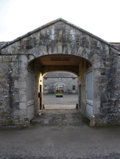 Ballinamore HouseFarmyard complex · 503 yd
Explorer Tom Ballinamore House has a farmyard complex with very strong opinions on modern buildings, mostly involving words like…
 Ballinamore BridgeBridge · 1075 yd
Explorer Tom Ballinamore Bridge has a family tree that’s mostly made up of ghosts and very confused engineers from the 1800s. It…
 Bullaun stone in CarrowndanganBullaun stone · 1076 yd
Explorer Tom Bullaun stone in Carrowndangan is involved in a fairy dispute over parking rights near St Patrick’s Well. It’s…
 Church in CarrowndanganChurch · 1109 yd
Explorer Tom Church in Carrowndangan is gone completely, which fits perfectly since there was a feud between two families over who…
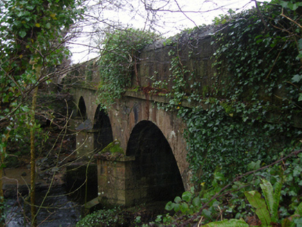 Linban BridgeBridge · 1476 yd
Explorer Tom Linban Bridge in Ballinamore is arching over the Geestaun River with a bit of flair that’s hard to ignore. It’s got…
 Fairy fort / earthen ringfort in Carrownageeragh (gallen By., Killeden Par.)Fairy fort / earthen ringfort · 1565 yd
Explorer Tom Fairy fort / earthen ringfort in Carrownageeragh has a terrible poem about itself that rhymes 'scarp' with 'sharp'. It…
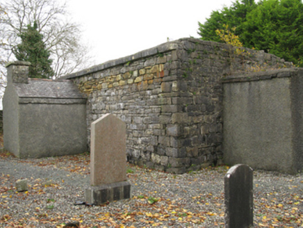 Ballinamore Church (Killedan)Church/chapel · 1.0 mi
Explorer Tom Ballinamore Church (Killedan) was paid for by Mr. Ormsby, who clearly liked his churches with pointed windows and a lot…
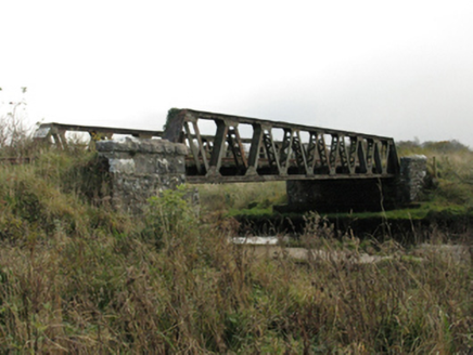 bridge1.2 mi
Explorer Tom Bridge in Carrownageeragh has a secret tunnel underneath leading straight to the pub, or so the legend goes. Built for…
 Sliabh Cairn PeakWalking route · 1.4 mi
Explorer Tom Sliabh Cairn Peak is going to win a county fair by simply standing there and looking majestic. It doesn't need a…
 Gilmartin Park, Kiltimagh GAAGAA ground · 2.2 mi
 Maghus Castle and Tir na nÓg PlaygroundChildren's playground · 2.7 mi
Explorer Tom Maghus Castle and Tir na nÓg Playground in County Mayo would order double chips and a mystery sauce at the chipper.…
More archaeology and monuments in County Mayo · All of County Mayo

What do you know about this place?Tap to add a comment or ask a question