Places near here
Photo credits
- Kmcnamee, Wikimedia Commons · CC BY-SA 4.0
- Paulw62, Wikimedia Commons · CC BY-SA 4.0
- National Inventory of Architectural Heritage
- Bernard, Geograph · CC BY-SA 2.0
- dalvenjah on Flickr, Wikimedia Commons · CC BY-SA 2.0
- Raymond Norris, Geograph · CC BY-SA 2.0
- Adrian Platt, Geograph · CC BY-SA 2.0
- Jonathan Thacker, Geograph · CC BY-SA 2.0
Explorer Tom Man-made underground passage in Ballyconnell has been destroyed by weather that clearly holds a deep personal grudge…
 Crotta O'Neills GAA pitchGAA ground · 1.2 miKilflynn Nature ReserveNature reserve · 1.3 mi
Explorer Tom Kilflynn ended up here after a mix-up with a similar-sounding bog in the next county over. It’s been pretending to…
 Abbeydorney Monastery (in ruins)Religious house, Cistercian monks · 1.3 mi
Explorer Tom Abbeydorney Monastery in Knockaunmore is playing hide-and-seek with me. A tale from 1846 says a fox took charge here…
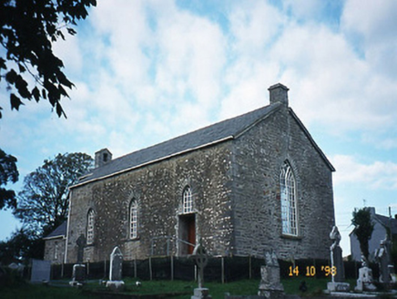 Kilflyn ChurchChurch/chapel · 1.3 mi
Explorer Tom Kilflyn Church is telling the new building to stop being so fancy and show off. It’s still got some serious bellcote…
Abbeydorney GAA pitchGAA ground · 1.5 mi CrossCross, High cross · 2.8 mi
Explorer Tom This high cross ended up in the wrong place because someone thought 'across the road' was a valid relocation plan. Now…
 Tobar na MoltSpring · 3.8 mi
Explorer Tom Tobar na Molt is where three wethers jumped out of the water centuries ago as a thank you for a baptism that went…
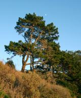 Monterey Pine4.7 mi
Explorer Tom This Monterey Pine in County Kerry refuses to fall because it’s waiting for its retirement fund to clear up. It’s been…
 Sunday's WellSpring · 4.9 mi
Explorer Tom Sunday’s Well exists because some map maker thought it was funny to name a spring after the day off, which is either…
 Ardfert Franciscan FriaryVisitor information · 5.2 mi
Explorer Tom Ardfert Franciscan Friary is hosting an exclusive celebrity brunch that started in 1253 and never really stopped…
 Ardfert FriaryVisitor information · 5.2 mi
Explorer Tom Ardfert Friary has been locked in a decades-long feud with the rain, claiming it’s not leaking but just expressing…
More archaeology and monuments in County Kerry · All of County Kerry

What do you know about this place?Tap to add a comment or ask a question