What is recorded here
From the National Monuments Service (Archaeological Survey of Ireland) record LA037-001
Places near here
Photo credits
- Maker not stated on source page, en.wikipedia.org
- National Inventory of Architectural Heritage
- Maker not stated on source page, uk.pinterest.com
- Maker not stated on source page, www.flickr.com
- Maker not stated on source page, in.pinterest.com
- Ian Rob, Geograph · CC BY-SA 2.0
- liam murphy, Wikimedia Commons · CC BY-SA 2.0
- Garry Dickinson, Wikimedia Commons · CC BY-SA 2.0
- Kk, Wikimedia Commons · CC0
- A.-K. D., Wikimedia Commons · CC BY-SA 4.0
- Willow, Wikimedia Commons · CC BY 2.5
 Mapped graveyardGraveyard · 1.5 mi
Explorer Tom This mapped graveyard in County Laois seems to have wandered off its intended plot entirely. It’s like the dead got…
 milestone/milepost1.5 mi
Explorer Tom Milestone or milepost in Monavea has one New Year’s resolution: to stop people stepping on its toes. It’s a limestone…
 CairnCairn, unclassified · 1.5 mi
Explorer Tom Cairn in Mayo looks like a pile of stones having a disagreement with gravity. A priest lost a bet here and never spoke…
 Fairy fort / earthen ringfort in CoorlaghanFairy fort / earthen ringfort · 1.6 mi
Explorer Tom Fairy fort / earthen ringfort in Coorlaghan thinks Dublin tourists are just overpriced sheep with bad accents and no…
 Mayo Graveyard (Killabban)Graveyard · 1.8 mi
Explorer Tom Mayo Graveyard (Killabban) would say 'I’m punctual' in a job interview, which is a lie because it’s always late. It’s…
 Killeshin ChurchVisitor information · 2.0 mi
Explorer Tom Killeshin Church was built in 1819 by someone who definitely had an escape plan ready in case things went south. It’s…
 Church (in Ruins)Church · 2.1 mi
Explorer Tom Church in Kilcoke (la028) has a tall tale about a hidden tunnel to the pub, which I am 90% sure is true because I've…
 Killeshin MoatCastle, motte · 2.1 mi
Explorer Tom Killeshin Moat sits on a ridge covered in thorns, making it the world’s most prickly pillow. Its first owner likely…
 CastleCastle, unclassified · 2.1 mi
Explorer Tom Castle in Killeshin has vanished so thoroughly that even the local sheep think it’s a myth. It was plundered twice…
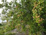 European Crab Apple2.7 mi
Explorer Tom European Crab Apple hears the neighbours arguing through its bark and pretends not to care. It produces tiny, sour…
 Kilgorey Old BurialVisitor information · 2.7 mi
Explorer Tom Kilgorey Old Burial is where the seagulls hold their weekly council meetings about who stole the crisps from the picnic…
 European ash2.7 mi
Explorer Tom European Ash here is pretending to be its twin across the sea, but we both know it’s just lonely. It’s got that 'I’m…
More archaeology and monuments in County Laois · All of County Laois

What do you know about this place?Tap to add a comment or ask a question