What is recorded here
Internal diam. c. 19m
On a gentle SE facing slope overlooking Brandon Bay, a circular enclosure is marked on the OS maps. This survives as a semi-circular platform raised, only on the downslope side, a maximum of 1.2m above the general level of the field. The straight side of the semi-circle is defined by a field wall. A spread of small stones covers the entire surface and flanks of the platform and these become denser towards the edge forming a barely discernible bank. This may be the site described in the OSNB (Cloghane, book 1, 43) as 'a heap of stones forming a kind of circle' with a small house and Man-made underground passage visible within. Cuppage, ‘Corca Dhuibhne. Dingle Peninsula archaeological survey. Ballyferriter. Oidhreacht Chorca Dhuibhne’ (1986), no. 647.
Internal diam. c. 19m On a gentle SE facing slope overlooking Brandon Bay, a circular enclosure is marked on the OS maps. This survives as a semi-circular platform raised, only on the downslope side, a maximum of 1.2m above the general level of the field. The straight side of the semi-circle is defined by a field wall. A spread of small stones covers the entire surface and flanks of the platform and these become…
From the National Monuments Service (Archaeological Survey of Ireland) record KE026-021
The monument record does not grant public access. Check the route and ask the landowner before entering private land.
- What survives
- Recorded monument
Places near here
Photo credits
- Sharon Loxton, Geograph · CC BY-SA 2.0
- Superbass, Wikimedia Commons · CC BY-SA 4.0
- National Inventory of Architectural Heritage
- colm, Geograph · CC BY-SA 2.0
- Adrian King, Geograph · CC BY-SA 2.0
- kevin higgins, Geograph · CC BY-SA 2.0
- markjhandel, Wikimedia Commons · CC BY 2.0
- Nigel Cox, Geograph · CC BY-SA 2.0
Fulacht fia in An CheapaighFulacht fia · 256 ydEnclosure in Baile Uí BhuinnEnclosure · 466 ydAn CheapaighBeach / strand · 579 yd Pointe na CathrachHeadland · 1379 ydCloghane ChurchRuins · 1.6 miSéipéal an Clochán [Cloghane Church]Church/chapel · 1.6 miCnoc DuíléibheMountain / peak · 2.2 miBrandon PointViewpoint · 2.3 miFermoyle BeachBeach / strand · 3.4 miPiaras MórMountain / peak · 3.8 miAn ChonairViewpoint · 5.4 miGurrig IslandIslet · 6.2 mi
 Pointe na CathrachHeadland · 1379 yd
 Cloghane ChurchRuins · 1.6 mi
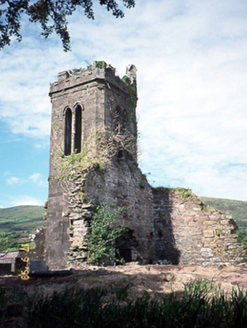 Séipéal an Clochán [Cloghane Church]Church/chapel · 1.6 mi
 Cnoc DuíléibheMountain / peak · 2.2 mi
 Brandon PointViewpoint · 2.3 mi
 Fermoyle BeachBeach / strand · 3.4 mi
 Piaras MórMountain / peak · 3.8 mi
 An ChonairViewpoint · 5.4 mi
 Gurrig IslandIslet · 6.2 mi
More archaeology and monuments in County Kerry · All of County Kerry
What do you know about this place?