What is recorded here
In pasture on E-facing slope. Shown as circular enclosure on OS 6-inch map (1842). Site levelled, lane to farmhouse runs through site; slight undulation noticeable in area.
From the National Monuments Service (Archaeological Survey of Ireland) record CO122-048
The monument record does not grant public access. Check the route and ask the landowner before entering private land.
- What survives
- Recorded monument
Places near here
Photo credits
- National Inventory of Architectural Heritage
- Maker named on the Wikimedia Commons picture page · Public domain
- Mike Searle, Wikimedia Commons · CC BY-SA 2.0
- Ceoil at English Wikipedia, Wikimedia Commons · CC BY-SA 3.0
- Kenneth Allen, Geograph · CC BY-SA 2.0
- Marathon, Wikimedia Commons · CC BY-SA 2.0
- Neville Goodman, Geograph · CC BY-SA 2.0
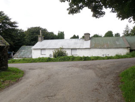 farm house1081 yd
 Ballinascarty BridgeBridge · 1261 ydMonteen Castle (in Ruins)Castle, tower house · 1671 yd
 English holly1.2 miGraveyard in KilmalodaGraveyard · 1.2 miGarden WoodWood · 1.9 mi
 Ballinoroher CastleCastle · 2.0 mi
 Stone CircleStone circle, multiple-stone · 2.9 mi
 Templebryan Stone CircleArchaeological place · 2.9 mi
 Clonakilty Tourist OfficeVisitor information · 4.2 mi
 Michael Collins House MuseumMuseum · 4.3 mi
 Clonakilty HarbourBay · 4.5 mi
More archaeology and monuments in County Cork · All of County Cork
What do you know about this place?