What is recorded here
In pasture, on slight NW-facing slope. Monument, depicted as penannular enclosure (diam. c. 10m) on 1923 OS 6-inch map, has been levelled. No trace of monument evident when inspected.
From the National Monuments Service (Archaeological Survey of Ireland) record LI042-013
The monument record does not grant public access. Check the route and ask the landowner before entering private land.
- What survives
- Recorded monument
Places near here
Photo credits
- National Inventory of Architectural Heritage
- Jonathan Thacker, Geograph · Creative Commons Attribution-ShareAlike 2.0
- Jonathan Thacker, Geograph · CC BY-SA 2.0
- Philip Halling, Geograph · CC BY-SA 2.0
- N Chadwick, Geograph · CC BY-SA 2.0
- No machine-readable author provided. Larsoner~commonswiki assumed (based on copyright claims)., Wikimedia Commons · Public domain
- Unknown author Unknown author, Wikimedia Commons · Public domain
- Mike Searle, Wikimedia Commons · CC BY-SA 2.0
- Wikimedia Commons contributor · CC BY-SA 3.0
Mound in Abbeyfeale EastMound · 268 ydMound in Kilkinlea UpperMound · 868 yd public house1712 ydReverend William Casey MonumentMonument · 1.0 miBarnagh HillMountain / peak · 4.8 miThree CountiesPicnic place · 6.0 miJohn B. KeaneMemorial · 9.1 miBryan MacMahonMemorial · 9.5 miListowel Castle (in ruins)Castle, tower house · 9.5 miLartigue MonorailMuseum · 9.8 miKilmurry CastleCastle · 10 miCrag CaveCave · 11 mi
 public house1712 yd
 Reverend William Casey MonumentMonument · 1.0 miBarnagh HillMountain / peak · 4.8 mi
 Three CountiesPicnic place · 6.0 mi
 John B. KeaneMemorial · 9.1 mi
 Bryan MacMahonMemorial · 9.5 mi
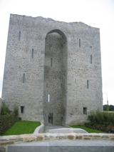 Listowel Castle (in ruins)Castle, tower house · 9.5 mi
 Lartigue MonorailMuseum · 9.8 mi
_-_geograph.org.uk_-_3037263.jpg/250px-Castles_of_Munster,_Kilmurry,_Kerry_(2)_-_geograph.org.uk_-_3037263.jpg "Photo: Mike Searle, Wikimedia Commons · CC BY-SA 2.0") Kilmurry CastleCastle · 10 mi
Kilmurry CastleCastle · 10 mi Crag CaveCave · 11 mi
More archaeology and monuments in County Limerick · All of County Limerick
What do you know about this place?