DDiscover AloneMapAbout

Emper Castle

Castle, tower house

What is recorded here

Situated on low natural hillock in pasture with ringfort (WM010-001----) and area marked as 'Old Town' on OS 6-inch map 300m to SSW. Inny River marking boundary with County Longford 800m to N. According to Woods (1907, 5) Emper Castle was once the seat of the Dalton family. The 1654-57 Down Survey map of Kilmacknevan…

Read the whole record
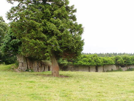
Situated on low natural hillock in pasture with ringfort (WM010-001----) and area marked as 'Old Town' on OS 6-inch map 300m to SSW. Inny River marking boundary with County Longford 800m to N. According to Woods (1907, 5) Emper Castle was once the seat of the Dalton family. The 1654-57 Down Survey map of Kilmacknevan parish recorded in 1641 that Emper Castle and its lands then belonged to Sir Oliver Tuite who was described as an 'Irish papist' (NLI MS 723-4). The terrier of this parish map recorded that 'there are three Castles in this parrish lately ruinous vizt. in Emper one' (ibid.). The Down Survey map of Moygoish Barony depicted Emper Castle as a rectangular shaped tower house with possible angle tower standing on top of a natural hillock (ibid.). The place-name 'Old Town' marked on the Ordnance Survey 6-inch map may mark the location of the medieval manor of Emper which is referred to in a patent dated September 15, 1338, when Theobald De Verdon was granted the right to hold one fair on Wednesday in Whitsun week and for seven following days. Empor Manor is mentioned in this fair patent (Anon. 1853, 115). In 1837 the castle ruins were described in the Ordnance Survey Memoranda by John O'Donovan as 'nearly a square building being about 40 feet [12.2m] long and 36 feet [10.9m] broad, and so high that I could scarcely throw a stone over it. a fair is annually held close to it, but I could not learn whether this fair was established while the castle was inhabited or since it fell to ruin. That this was one of the Daltons' castles, though not in the barony of Rathconrath, we learn from Mac Firbhisigh' (Walsh 1957, 103-4). Emper Castle was described in the Schools' Collection (1937-39) as following; 'When this castle was built it was four storey high and now there are only two walls left standing. Around the castle there still remains some of the fortifications also a cave and outside that again an immense graveyard where some bishops are buried. Adjoining the castle is an old fort which is of Danish origin' (The Schools' Collection, Volume 0740, page 003). According to the Schools' Collection the local folklore recorded that the castle was built in 1170 by the Anglo-Normans for D'Alton family who were of French descent (ibid.). However the annals recorded that in 1405 'The castle of Imper was built by Andrew son of Henry son of Nicholas Dalton' (Ó hInnse 1947, 175). In 1610 Sir Hamond Le Strange of Hunstanton in Norfolk, heir of Thomas Le Straunge of Ballymore-Loughseudy, Co. Westmeath sold 'half of Imper castle' to John Jay or Gay of Holveston in Norfolk (Cal. pat. rolls Ire., Jas I, 252). Poorly preserved remains of a rectangular tower (ext. dims. 13.3m NW-SE x 11.7m NE-SW; int. dims. 9m NW-SE x 7.4m NE-SW; wall T c. 2.1m; wall T above batter c. 0.9m) standing two storeys high (max. H c. 13m), built with roughly coursed rubble with high base-batter visible on E face. The NW wall is the best preserved with large breaches in the NE, SE and SW walls. The NW wall is featureless at ground floor level with no openings visible. A straight sided opening located off centre to S in the SW wall may be the remains of a possible ground floor entrance into the tower. The springers of a stone vault covering the ground floor are visible in the NW and NE walls. According to Salter (2004, 149) the ground floor of the castle was divided with a cross-wall running NW-SE which supported the stone vaulting. A small rectangular shaped window is visible at first floor level in the NW wall. The low wall footings of a levelled rectangular structure built onto the SE side of the castle are also visible. Earthworks consisting of low linear banks and ditches to the NW, N, E and SE of the castle which are visible on Digital Globe aerial photograph taken November 2011 probably represents the remains of a levelled bawn (WM010-002001-).

From the National Monuments Service (Archaeological Survey of Ireland) record WM010-002

The monument record does not grant public access. Check the route and ask the landowner before entering private land.

What do you know about this place?Tap to add a comment or ask a question

What you write will be public.

Places near here

Photo credits
  • National Inventory of Architectural Heritage
  • Willow, Wikimedia Commons · CC BY 2.5
  • Algirdas at Lithuanian Wikipedia, Wikimedia Commons · Public domain
  • Kmcnamee, Wikimedia Commons · CC BY-SA 4.0
Newtown HouseHouse · 1.2 mi

Explorer Tom Newtown House bragged about surviving a massive storm in the late Georgian era by simply standing still and looking…

post box1.2 mi

Explorer Tom The post box in Carrigeen has very strong opinions on modern buildings, thinking they look like melted cheese compared…
Saint Matthew's Catholic ChurchChurch/chapel · 1.3 mi

Explorer Tom Saint Matthew's Church in Churchtown is a modest little chapel dated 1829 that seems to be holding its breath. The…
ShawbrookHouse · 1.3 mi

Explorer Tom Shawbrook in Carrigeen, County Longford is so low-slung and long that I bet the Vikings walked right past it thinking…
Ballynacarrow BridgeBridge · 1.3 mi

Explorer Tom Ballynacarrow Bridge has a fan club of local goats who just want to lean on the rusticated masonry for support. It’s…
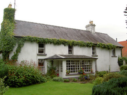
Newport HouseHouse · 1.3 mi

Explorer Tom Newport House in Aghnavealoge is proud of its narrow plan and eaves-level windows. It thinks it’s a sophisticated…
Common Alder1.4 mi

Explorer Tom Common Alder in Longford is having a fake royal visit that nobody can disprove because no one saw it happen. It's a…
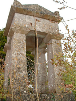
graveyard/cemetery1.6 mi

Explorer Tom Graveyard or cemetery in Churchtown is full of smuggling stories, like the time they hid a crate of illegal whiskey…
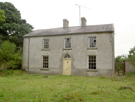
Castle FarmHouse · 1.8 mi

Explorer Tom Castle Farm in Ardanragh, County Longford has a symmetrical front that looks like it’s been ironed so many times it’s…
Fox HallWalled garden · 1.8 mi

Explorer Tom Fox Hall in Foxhall is a walled garden that probably posts selfies of its roses daily. The cast-iron gate looks like…

Pedunculate Oak1.9 mi

Explorer Tom Pedunculate Oak in County Longford caused a feud because two families argued over who owned the view from its top…

Flood Park, Legan SarsfieldsGAA ground · 2.2 mi

More castles and forts in County Westmeath · All of County Westmeath

Add to this placeAdd a picture Add a detailed tip Add a story

Explore the map1,095,414 places to discover

Next place · or swipeNewtown House