
What is recorded here
From the National Monuments Service (Archaeological Survey of Ireland) record WX002-014
Places near here
Photo credits
- Maker not stated on source page, ru.pinterest.com
- Maker not stated on source page, ca.pinterest.com
- Maker not stated on source page, www.dreamstime.com
- Maker not stated on source page, roaringwaterjournal.com
- National Inventory of Architectural Heritage
- Maker not stated on source page, commons.wikimedia.org
- Maker not stated on source page, pl.pinterest.com
- Jonathan Billinger, Wikimedia Commons · CC BY-SA 2.0
- Sarah777 at English Wikipedia, Wikimedia Commons · Public domain
- surrealpenguin, Wikimedia Commons · CC BY-SA 2.0
- Maker not stated on source page, www.flickr.com
- Kmcnamee, Wikimedia Commons · CC BY-SA 4.0
 CastleCastle, unclassified · 828 yd
Explorer Tom Castle in Pallishill is bragging about surviving storms that probably never happened, just to sound impressive to the…
 Standing stone in Monalee (gorey By.)Standing stone · 1.1 mi
Explorer Tom Standing stone in Monalee is perched on Croghaun Mountain, probably rolling its eyes at the road that leads nowhere…
 Kilninor CemeteryGraveyard · 1.1 mi
Explorer Tom Kilninor Cemetery has a long-standing grudge against the weather because the rain keeps washing away its carefully…
 Church in Glebe (gorey By., Limerick Ed)Church · 1.1 mi
Explorer Tom Church in Glebe is actually run by a dog that guards the gate with intense suspicion and zero mercy. It’s a D-shaped…
 graveyard/cemetery1.1 mi
Explorer Tom Graveyard or cemetery in Glebe has a hidden message in its stones, but only the really stubborn dead can read it…
 CairnCairn, burial cairn · 1.2 mi
Explorer Tom Annagh Long’s cairn was nearly sold to a farmer for a horse, but the buyer backed out when he saw how much effort it…
 Cist in Annagh LongCist · 1.2 mi
Explorer Tom This cist in Annagh Long has a family tree that is 90% made-up gossip about uncles who ran off with the neighbours’…
 Monalee HillMountain / peak · 1.2 mi
Explorer Tom Monalee Hill suspects the postman is stealing letters and hiding them in the turf. It’s been glaring at the road every…
 Annagh HillMountain / peak · 2.0 mi
Explorer Tom Annagh Hill above Ballyfad offers woodland climbing, open views and a hurling tale bold enough to make Tom suspicious…
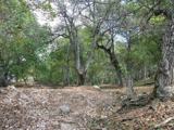 Persian Walnut2.1 mi
Explorer Tom Persian Walnut in County Wexford had a fiddler playing all night until the locals threatened to throw rocks at him. He…
 Limerick CemeteryCemetery · 2.1 mi
Explorer Tom Limerick Cemetery in County Wexford had a matchmaker who thought she could pair off the ghosts with the living folks…
 Kilanerin-Ballyfad GAAGAA ground · 2.3 mi
More archaeology and monuments in County Wexford · All of County Wexford

What do you know about this place?Tap to add a comment or ask a question