
Places near here
Photo credits
- National Inventory of Architectural Heritage
- Kmcnamee, Wikimedia Commons · CC BY-SA 4.0
- Algirdas at Lithuanian Wikipedia, Wikimedia Commons · Public domain
- Sciadopitys from UK, Wikimedia Commons · CC BY-SA 2.0
- liam murphy, Wikimedia Commons · CC BY-SA 2.0
- 瑞丽江的河水, Wikimedia Commons · CC BY-SA 4.0
- Darrin Antrobus, Wikimedia Commons · CC BY-SA 2.0
- Colin Park, Geograph · CC BY-SA 2.0
- N Chadwick, Wikimedia Commons · CC BY-SA 2.0
- kevin higgins, Geograph · CC BY-SA 2.0
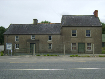 farm house984 yd
Explorer Tom Farm house in Mountfin Lower or Ballinturner was designed by a mother-in-law who wanted every window to be exactly the…
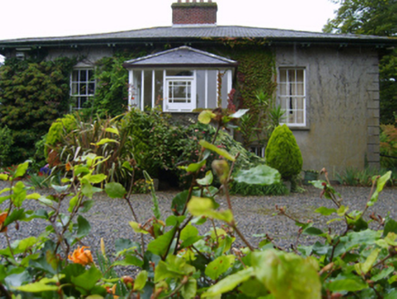 RosemountFarm house · 1015 yd
Explorer Tom Rosemount in Tomgarrow bragged about surviving a storm so bad it actually made the River Slaney change direction for a…
 Marshalstown Castledockrell GAA pitchGAA ground · 1.2 mi
 Pedunculate Oak2.2 mi
Explorer Tom Pedunculate Oak in County Wexford is showing off its acorns like it’s on a dating app. It thinks it can handle reality…
 European Larch2.7 mi
Explorer Tom European Larch has a family tree that’s mostly made up, just like my excuse for being late. It drops its needles every…
St. Aidan's GAA, FernsGAA ground · 3.4 mi Ferns CastleVisitor attraction · 3.9 mi
Explorer Tom Ferns Castle had a massive feud with the next village over something completely daft like whose turn it was to repair a…
 Ferns Castle (in ruins)Castle, Anglo-Norman masonry castle · 3.9 mi
Explorer Tom Ferns Castle’s secret talent is surviving every single siege by hiding behind a very convincing disguise as a regular…
 Battle of EnniscorthyBattle · 5.4 mi
Explorer Tom The Battle of Enniscorthy happened because someone lost an apple pie in the mud. The wind has been picking at the site…
 IndicatedCastle, tower house · 5.4 mi
Explorer Tom Castle in Enniscorthy thinks tourists from Dublin are just noisy pigeons that need to be shooed away. It grew around a…
 Battlefield in Ballyprecas,newtownbarryBattlefield · 5.6 mi
Explorer Tom Battlefield in Ballyprecas has a prophecy that says it will turn into gold on a Tuesday, which has never happened…
 John's HillMountain / peak · 7.0 mi
Explorer Tom John's Hill in County Carlow witnessed a love story that went badly wrong right next to its base. The couple argued…
More archaeology and monuments in County Wexford · All of County Wexford

What do you know about this place?Tap to add a comment or ask a question