What is recorded here
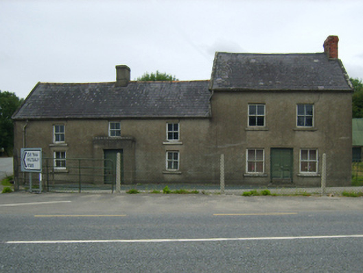
Attached three-bay single-storey lobby entry farmhouse with half-dormer attic, extant 1840, on a T-shaped plan centred on single-bay single-storey flat-roofed windbreak. Now disused. Pitched slate roof with terracotta ridge tiles centred on fine roughcast chimney stack having rendered capping, rendered coping to gables, and cast-iron rainwater goods on fine roughcast slate flagged eaves retaining cast-iron downpipes. Fine roughcast battered walls. Square-headed central door opening with concealed dressings framing timber boarded door. Square-headed window openings with rendered sills, and concealed dressings framing two-over-two timber sash windows; (north): Attached two- or three-bay two-storey house, extant 1904, on a rectangular plan with single-bay two-storey rear (west) elevation. Now disused. Pitched slate roof with clay ridge tiles, lichen-spotted rendered coping to gables with red brick Running bond chimney stack to apex (north) having corbelled stepped capping, and cast-iron rainwater goods on fine roughcast slate flagged eaves retaining cast-iron downpipes. Fine roughcast walls. Square-headed central door opening with concealed dressings framing timber panelled door. Square-headed window openings with rendered sills, and concealed dressings framing two-over-two timber sash windows. Road fronted on a corner site.
A farmhouse identified as an integral component of the vernacular heritage of County Wexford by such attributes as the compact rectilinear lobby entry plan form centred on a characteristic windbreak; the feint battered silhouette; the disproportionate bias of solid to void in the massing compounded by the uniform or near-uniform proportions of the openings on each floor; and the high pitched roofline.
This does not grant access. Most recorded buildings are privately owned; view them only from public ground unless the owner allows entry.
Places near here
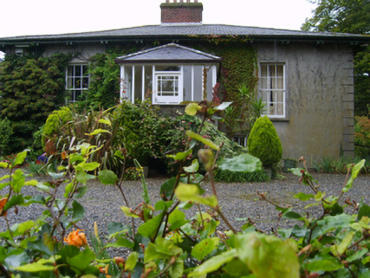 Rosemountfarm house · 408 yd
 Ballycarney Br.Bridge · 414 yd
 Enclosure in BallycarneyEnclosure · 1047 yd
 Enclosure in TincurryEnclosure · 1.2 mi
 Tombrick WoodForest · 1.7 mi
 CastleCastle, unclassified · 2.5 mi
 European LarchEuropean Larch · 2.6 mi
 Ferns Castle (in ruins)Castle, Anglo-Norman masonry castle · 3.4 mi
 Gibbet HillMountain / peak · 6.5 mi
 John's HillMountain / peak · 7.2 mi
 Barragh Church (in ruins), GraveyardChurch · 7.7 mi
 St Bridget's WellSpring · 7.8 mi
Other information
Photo: National Inventory of Architectural Heritage · Website use allowed for educational or private purposes with source credit