
What is recorded here
From the National Monuments Service (Archaeological Survey of Ireland) record WA031-030
Places near here
Photo credits
- Golfing in Ireland; photographer not stated, Source publisher
- Stephan van Helden, Wikimedia Commons · CC BY-SA 4.0
- National Inventory of Architectural Heritage
- P L Chadwick, Geograph · Creative Commons Attribution-ShareAlike 2.0
- Maker not stated on source page, www.dreamstime.com
- Alexander Redfern, Wikimedia Commons · CC BY-SA 4.0
- Kmcnamee, Wikimedia Commons · CC BY-SA 4.0
- Maker not stated on source page, sketchfab.com
- Colin Park, Geograph · CC BY-SA 2.0
- Slamforeman, Wikimedia Commons · CC BY 4.0
- Maker not stated on source page, en.wikipedia.org
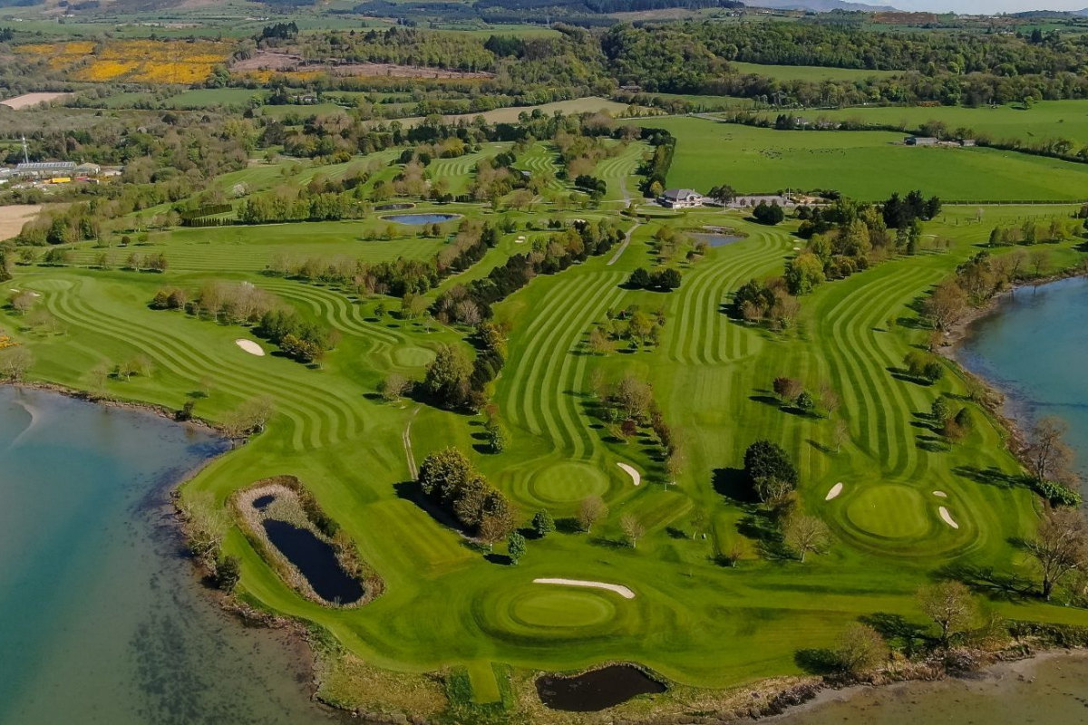 Dungarvan Golf ClubGolf course · 419 yd
 Horse-chestnut772 yd
Explorer Tom Horse-chestnut in County Waterford is sick of being asked if its fruits are actually edible, especially when they taste…
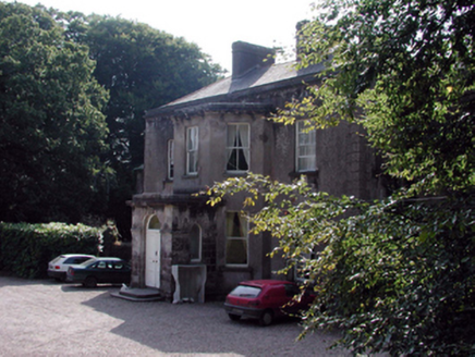 CloncoskraineHouse · 783 yd
Explorer Tom Cloncoskraine in Knockahavaun is where a fiddler played all night until the sun came up and the cows started dancing!…
 Saint Laurence's Catholic ChurchChurch/chapel · 1162 yd
Explorer Tom Saint Laurence's in Garrynageragh West nearly got famous because someone claimed it was haunted by a guy who lost his…
 Kilminnin GraveyardGraveyard · 1189 yd
Explorer Tom Kilminnin Graveyard explains the 1800s to teenagers by saying it was basically Instagram but with worse lighting and…
 Barnawee BridgeOfficially recorded historic building · 1193 yd
Explorer Tom Barnawee Bridge makes a strange creaking sound at night that locals swear is actually the ghost of an engineer checking…
 Abbeyside / Ballinacourty GAA pitchGAA ground · 1437 yd
 farm house1628 yd
Explorer Tom Farm house in Kilminnin South has given up its thatch for Lent, claiming it was too heavy for its conscience and now…
 Stone head in AbbeysideStone head · 1.9 mi
Explorer Tom Stone head in Abbeyside is a bishop carved into sandstone, looking perpetually annoyed at anyone who walks past without…
 Cunnigar PointHeadland · 2.1 mi
Explorer Tom Cunnigar Point really dislikes when tourists try to take selfies with their backs turned. It finds them incredibly…
 Waterford County MuseumMuseum · 2.1 mi
Explorer Tom Waterford County Museum in Dungarvan holds the local stories that can vanish when a grand national history marches past…
 Mapped cemeteryCemetery · 2.2 mi
Explorer Tom Mapped Cemetery in County Waterford is throwing a bit of a wobble because a fox decided to take charge last Tuesday. He…
More archaeology and monuments in County Waterford · All of County Waterford

What do you know about this place?Tap to add a comment or ask a question