
What is recorded here
On a rise at the crest of a WNW-ESE ridge. Oval grass-covered area (dims 45.5m N-S; 37m E-W) defined by scarps (H 0.8m at E to 2.4m at W) with a slight bank (Wth c. 2m; max. int. H 0.5m) on the perimeter NW-NE. The ramp entrance (Wth 3m) is at S, but there is no visible fosse. There are two grass-covered quarry pits in the interior and it is surrounded by straight field banks at S, W and N. The pitfield (RO021-042028-) and field system (RO021-042046-) are just to the NW, on the other side of an E-W public road. See the attached view from the E.
Compiled by: Michael Moore
Date of upload: 24 August 2010
From the National Monuments Service (Archaeological Survey of Ireland) record RO021-042030
Places near here
Picture notes
- Computer-made picture. It does not show this monument.
- Gillaween, Wikimedia Commons · CC BY-SA 4.0
- Sawyer777, Wikimedia Commons · CC BY-SA 4.0
- Willow, Wikimedia Commons · CC BY 2.5
- National Inventory of Architectural Heritage
 Field system in CarnakitField system · 188 ydComputer-made picture
 Fairy fort / earthen ringfort in CarnakitFairy fort / earthen ringfort · 234 ydComputer-made picture
 Pitfield in CarnakitPitfield · 279 ydComputer-made picture
 BarrowBarrow, ring-barrow · 326 ydComputer-made picture
 Enclosure in CarnakitEnclosure · 347 ydComputer-made picture
 indicatedFairy fort / earthen ringfort · 410 ydComputer-made picture
 Enclosure in GlenballythomasEnclosure · 593 ydComputer-made picture
 CloghannagorpCourt tomb · 600 ydComputer-made picture
 The Mórrígan: OweynagatLegend location · 1288 yd
Explorer Tom The Mórrígan: Oweynagat is called the Cave of Cats, which fooled me into expecting a very ordinary sort of trouble. Then the tale sends the Mórrígan out of it during the Táin. If the cats saw her coming, I bet they made room.
 Queen Medb: RathcroghanLegend location · 1.1 mi
Explorer Tom Queen Medb: Rathcroghan is where the Táin starts turning a quarrel about a bull into an epic. Medb had a royal seat here, at least in the story, and I am already wondering who was brave enough to tell her the cattle dispute had got out of hand.
 European ash1.8 mi
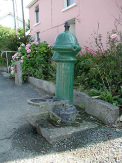 water pump4.3 mi
More archaeology and monuments in County Roscommon · All of County Roscommon

What do you know about this place?Tap to add a comment or ask a question