What is recorded here
Located approximately 100m to the north of KE038-094----. It takes the form of a large circular earthen bank, which measures 50m N-S by 49m E-W and encloses a circular depression 27m N-S by 26m E-W. No trace of an external ditch could be found, and it therefore seems likely that the bank was constructed by scooping out material from the interior and piling it so as to create the enclosing element. This would also account for the dish-like appearance of the interior, which at its deepest is almost 2m below the level of the top of the bank. The bank has an average width of 9m and is 0.4m above external ground surface. As in the example of the embanked enclosure at Tonavane, the field in which this site occurs has undergone intensive cultivation, and so probably denuding this site considerably. This is probably the reason that it is difficult to trace the enclosing element at west, although the site can still be seen in its entirety from the colour aerial photograph taken from 5000 feet.
Located approximately 100m to the north of KE038-094----. It takes the form of a large circular earthen bank, which measures 50m N-S by 49m E-W and encloses a circular depression 27m N-S by 26m E-W. No trace of an external ditch could be found, and it therefore seems likely that the bank was constructed by scooping out material from the interior and piling it so as to create the enclosing element. This would also…
From the National Monuments Service (Archaeological Survey of Ireland) record KE038-093
The monument record does not grant public access. Check the route and ask the landowner before entering private land.
- What survives
- Recorded monument
Places near here
Photo credits
- National Inventory of Architectural Heritage
- Garry Dickinson, Geograph · CC BY-SA 2.0
- Lors2016, Wikimedia Commons · CC BY-SA 4.0
- Willow, Wikimedia Commons · CC BY 2.5
- Sitomon, Wikimedia Commons · CC BY-SA 2.0
- ATJWen, Wikimedia Commons · CC BY-SA 4.0
- Robert Linsdell from St. Andrews, Canada, Wikimedia Commons · CC BY 2.0
- Wikimedia Commons contributor · CC BY-SA 3.0
- Ian Taylor, Geograph · CC BY-SA 2.0
- Raymond Norris, Geograph · CC BY-SA 2.0
- Bernard, Geograph · CC BY-SA 2.0
Enclosure in BallyseedyEnclosure · 246 yd Ballyseede CastleCountry house · 388 ydBallyseede Castle HotelCastle · 399 ydBallyseedy Church (in ruins)Church · 403 ydCommon Alder663 ydEuropean Yew1292 ydOgham stone in RatassOgham stone · 1.6 miCivil War MemorialMemorial · 2.0 miKerry County MuseumMuseum · 2.5 miSonny McCarthy MemorialMonument · 2.5 miKnockmichael MountainMountain / peak · 3.3 miTobar na MoltSpring · 5.9 mi
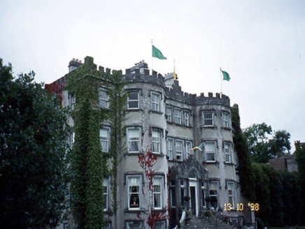 Ballyseede CastleCountry house · 388 yd
 Ballyseede Castle HotelCastle · 399 yd
 Ballyseedy Church (in ruins)Church · 403 yd
 Common Alder663 yd
 European Yew1292 yd
 Ogham stone in RatassOgham stone · 1.6 mi
_(27283083824).jpg/250px-Civil_War_Memorial._Church_St,_Ring_of_Kerry,_Cahersiveen_(506519)_(27283083824).jpg "Photo: Robert Linsdell from St. Andrews, Canada, Wikimedia Commons · CC BY 2.0") Civil War MemorialMemorial · 2.0 mi
Civil War MemorialMemorial · 2.0 mi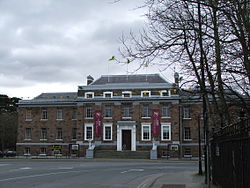 Kerry County MuseumMuseum · 2.5 mi
 Sonny McCarthy MemorialMonument · 2.5 mi
 Knockmichael MountainMountain / peak · 3.3 mi
 Tobar na MoltSpring · 5.9 mi
More archaeology and monuments in County Kerry · All of County Kerry
What do you know about this place?