
What is recorded here
From the National Monuments Service (Archaeological Survey of Ireland) record WX031-030
Places near here
Photo credits
- Maker not stated on source page, commons.wikimedia.org
- Maker not stated on source page, au.pinterest.com
- National Inventory of Architectural Heritage
- Maker not stated on source page, www.youtube.com
- Maker not stated on source page, www.theirishroadtrip.com
- Maker not stated on source page, storage.googleapis.com
- Maker not stated on source page, en.wikipedia.org
- Kmcnamee, Wikimedia Commons · CC BY-SA 4.0
 CastleCastle, unclassified · 382 yd
Explorer Tom Castle in Coolnagree has been hiding a scandal involving a missing bishop and a very expensive hat for centuries. It’s…
 Graveyard in DoonooneyGraveyard · 447 yd
Explorer Tom Graveyard in Doonooney has a hidden message in its stones if you squint hard enough, but it’s mostly just telling…
 Doonooney CastleRuins · 573 yd
Explorer Tom Doonooney Castle is so fancy it wrote its own haiku about being crumbling. It thinks its broken roofline looks like a…
 farm house1753 yd
Explorer Tom Farm house in Rathkyle thinks the map makers got it wrong because they were drunk on cheap cider that day. It’s got a…
 Mapped graveyardGraveyard · 1.2 mi
Explorer Tom Mapped graveyard in County Wexford would cope on a reality show by refusing to participate in any challenges because it…
 Church (in ruins)Church · 1.2 mi
Explorer Tom Church in Barmoney is stuck in a long-standing grudge with the weather for blowing away its roof. It looks like a…
 Fairy fort / earthen ringfort in CamarossFairy fort / earthen ringfort · 1.4 mi
Explorer Tom Fairy fort / earthen ringfort in Camaross is fifty meters of pure cropmark energy that only shows up when the weather…
 Fairy fort / earthen ringfort in CastlehaystownFairy fort / earthen ringfort · 1.4 mi
Explorer Tom Fairy fort / earthen ringfort in Castlehaystown is holding a fake world record for being invisible while pretending to…
 Site of Haystown CastleMoated site · 1.6 mi
Explorer Tom Site of Haystown Castle in Castlehaystown, County Wexford would be a disaster on any reality show because it has zero…
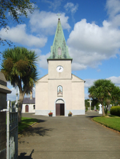 Catholic Church of Saint John the BaptistChurch/chapel · 1.6 mi
Explorer Tom Catholic Church of Saint John the Baptist in Galbally thinks tourists from Dublin are all talk and no prayer because…
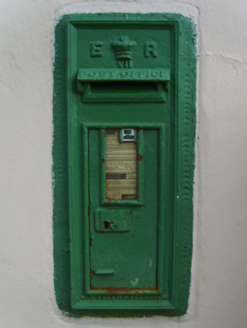 post box1.6 mi
Explorer Tom Post box in Galbally is standing guard like it’s owed money, wearing King Edward VII’s royal cipher like a fancy hat.…
 St. Abban's GAA, AdamstownGAA ground · 1.9 mi
More archaeology and monuments in County Wexford · All of County Wexford

What do you know about this place?Tap to add a comment or ask a question