
Places near here
Photo credits
- E. H. (E. Hayden), Wikimedia Commons · Public domain
- National Inventory of Architectural Heritage
- MonikaLisa2, Wikimedia Commons · CC BY-SA 4.0
- Hywel Williams, Geograph · Creative Commons Attribution-ShareAlike 2.0
- Hywel Williams, Wikimedia Commons · CC BY-SA 2.0
- Mike Searle, Geograph · CC BY-SA 2.0
- Willow, Wikimedia Commons · CC BY 2.5
- dougf, Geograph · CC BY-SA 2.0
- Gfwc70, Wikimedia Commons · CC BY-SA 4.0
 Strancally Castle (in ruins)Castle, hall-house · 1548 yd
Explorer Tom Strancally Castle has strict rules for visitors: no touching the rock, no asking about the rebellion, and definitely no singing off-key near the water. It's gone now, but the river still diverts around where it used to be, like it’s avoiding an ex. Find the date carved somewhere and feel clever.
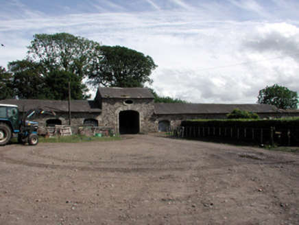 Clashmore HouseOutbuilding · 1.3 mi
Explorer Tom Clashmore House is an outbuilding standing alone because the main house vanished, like a body without a head at a fancy dinner. Local legend says a giant once used it as a shoebox, which explains why the stone masonry is so incredibly heavy and serious-looking for such a simple agricultural spot.
 Clashmore Heritage CentreHeritage attraction · 1.6 mi
Explorer Tom Clashmore Heritage Centre in County Waterford witnessed a dramatic event where a chandelier fell onto a mannequin and everyone thought it was a ghost attack. Nobody believed it was just gravity until the police showed up with their clipboards and serious faces. Bring your worst joke because this place has heard worse from tourists with bad accents.
 vent pipe1.6 mi
Explorer Tom Vent pipe in Coolbooa has a tall tale about a hidden tunnel that leads straight to the local pub cellar. It’s a disused sewage feature that thinks it’s an aesthetic masterpiece, which is bold for a pipe. Just wave at it from a safe distance!
Dromore WoodWood · 2.4 miExplorer Tom This Dromore Wood’s New Year's resolution is to stop losing leaves in autumn because it finds the whole process incredibly tedious and messy every single year. It wants to be evergreen but lacks the commitment and the budget for a makeover. Make up your own legend and I'll swear it's true.
 Saint Declan's Holy WellSpring · 2.6 mi
Explorer Tom This Saint Declan's Holy Well is where an ancient matchmaker arranged dates for lonely farmers seeking wives. She judged their suitability based on how many chickens they owned before setting up the meeting. Ideal for a moody photo you'll pretend wasn't posed.
 Ogham StonesOgham stone · 3.0 mi
Explorer Tom Ogham Stones in Dromore are secretly proud of one specific potato that grew near their base back in the day. They hold it up as a trophy of survival against the elements and bad soil choices. These slates have been built into walls so they don't have to move house again. If it's closed, admire it from the road like a polite stalker.
 Molana AbbeyHeritage attraction · 3.2 mi
Explorer Tom Molana Abbey in County Waterford is having a total meltdown on reality TV right now. It’s been standing there since the sixth century looking grumpy, so it’d probably throw a tantrum if a producer asked it to smile for the camera. Go on, count the windows and get it wrong like I did.
St Bridget's WellSpring · 3.3 miExplorer Tom St Bridget's Well would easily win a county fair blue ribbon for best water source. It has been serving thirsty locals since before records existed, and it never once ran dry or stopped bubbling. Best visited with a curious kid and no timetable.
 European ash3.3 mi
Explorer Tom European ash in County Waterford somehow ended up in the wrong place, probably because it got confused on its way to a different forest. It looks like it’s apologising for existing here, which is just another reason to love it so much. Perfect detour when the satnav has a meltdown.
 Templemichael CastleCastle · 3.4 mi
Explorer Tom Templemichael Castle in County Waterford has a name that sounds like someone said 'temple' and 'Michael' at the same time while eating soup. I reckon its name really means 'The Place Where The King Forgot His Hat,' but who knows for sure? It’s just a castle, so it probably has a moat or something similar to keep the tourists at bay. Go before the tourists find out.
 Site of ChurchChurch · 3.4 mi
Explorer Tom Site of Church in Templemichael is stuck in a feud with the clouds. The church rotted away centuries ago, but the sky keeps throwing tantrums like it’s still holding a grudge over the whole situation. It's free, it's odd, what more do you want?
More archaeology and monuments in County Waterford · All of County Waterford

What do you know about this place?Tap to add a comment or ask a question