
Places near here
Photo credits
- National Inventory of Architectural Heritage
- Roscommon Herald (publisher); individual photographer not named for this image, www.roscommonherald.ie
- Mike Searle, Wikimedia Commons · CC BY-SA 2.0
- Sitomon, Wikimedia Commons · CC BY-SA 2.0
- Willow, Wikimedia Commons · CC BY 2.5
- Maker not stated on source page, www.tripadvisor.ie
- Maker not stated on source page, www.tripadvisor.co.nz
- Maker not stated on source page, uk.pinterest.com
- Maker not stated on source page, www.flickr.com
- Maker not stated on source page, www.dreamstime.com
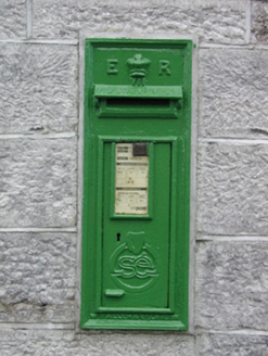 post box1.2 mi
Explorer Tom Post box in Cams in Cloverhill witnessed a love story that went badly wrong next to it. They argued over whether it was…
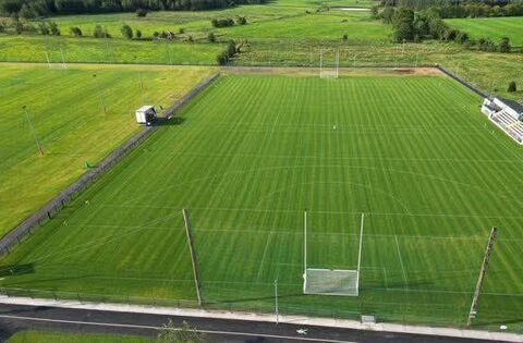 Rockfield, Oran GAAGAA ground · 1.5 mi
 Castlecoote HouseCountry house · 1.7 mi
Explorer Tom Castlecoote House in Castlecoote is a mix of an eighteenth-century mansion and a seventeenth-century castle, like…
 European Yew1.7 mi
Explorer Tom European Yew in County Roscommon had a cow try to buy it once, which is either genius or absolute madness. The tree…
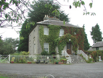 The VicarageRectory/glebe/vicarage/curate's house · 1.7 mi
Explorer Tom The Vicarage keeps getting picked on by the wind because it thinks its limestone steps are too pretty to be left alone…
 European ash1.7 mi
Explorer Tom European ash in County Roscommon would have given Saint Patrick a real headache if he’d tried to move it out of…
 CastleCastle, unclassified · 1.8 mi
Explorer Tom Castle in Fuerty is where a poet once fell in the ditch and wrote a very bad sonnet about it. It’s burnt out now, which…
 Dunamon CastleCastle, unclassified · 2.0 mi
Explorer Tom Dunamon Castle has been destroyed, but it still thinks it’s got a point to make about being built in twelve hundred and…
 Graveyard in Emlagh MoreGraveyard · 2.1 mi
Explorer Tom Graveyard in Emlagh More is having a massive staring contest with that one lonely tree on the slope. The locals say the…
 Fairy fort / ringfort in MillfordFairy fort / ringfort · 4.8 mi
Explorer Tom Fairy fort / ringfort in Millford is a circle on a map that reality decided to delete, with half of it levelled off…
 Fairy fort / earthen ringfort in MillfordFairy fort / earthen ringfort · 4.9 mi
Explorer Tom Fairy fort / earthen ringfort in Millford has been flattened so much it’s basically a memory now, with a silage pit…
 Creggs GAA PitchGAA ground · 5.0 mi
More archaeology and monuments in County Roscommon · All of County Roscommon

What do you know about this place?Tap to add a comment or ask a question