
What is recorded here
Marked as an oval embanked enclosure (ext. dims c. 60m NE-SW; c. 40m NW-SE) on the 1839 ed. of the OS 6-inch map and as two E-W banks inside NW-SE field banks at NE and SW on the 1924 ed. It is situated on a gentle E-facing slope at the E-facing foothills of Slievecoilte with a slight W-E valley just to the S and a…
Read the whole record
From the National Monuments Service (Archaeological Survey of Ireland) record WX034-037
Places near here
Photo credits
- Maker not stated on source page, www.pinterest.com
- National Inventory of Architectural Heritage
- Mike Searle, Wikimedia Commons · CC BY-SA 2.0
- Maker not stated on source page, www.dreamstime.com
- Maker not stated on source page, ca.pinterest.com
- David Purchase, Wikimedia Commons · CC BY-SA 2.0
- Maker not stated on source page, www.theirishroadtrip.com
- seegraswiese, Wikimedia Commons · CC BY-SA 3.0
 Castle (Site Of)Ruins · 392 yd
Explorer Tom The first owner of this Castle had an escape plan involving a rope made from braided eyebrows, but he forgot to check…
 kiln740 yd
Explorer Tom The kiln in Ballymaclare has been feuding with the rain for centuries, mostly by losing every round without complaint.…
 Castle (in ruins)Castle, tower house · 1420 yd
Explorer Tom Castle in Tellarought once had a huge argument about whether it was actually haunted or just really bad at maintaining…
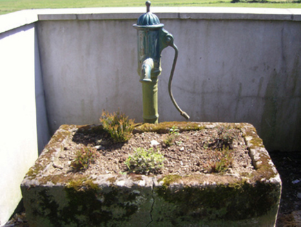 water pump1428 yd
Explorer Tom Water pump in Aughclare has a tail like a cow but the soul of a romantic, made by Jessop Davis back when romance meant…
 Saint Brigid's CemeteryCemetery · 1454 yd
Explorer Tom Saint Brigid's Cemetery has a secret talent for growing moss in shapes that look like angry cats. The locals swear it’s…
 Church (in ruins)Church · 1461 yd
Explorer Tom Church in Tellarought is sitting there looking smug because someone wrote a poem about it so bad even the crows flew…
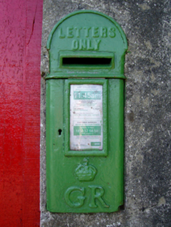 post box1494 yd
Explorer Tom Post box in Aughclare thinks Saint Patrick would have used it to store his shamrocks instead of losing them everywhere.…
 SlievecoiltiaMountain / peak · 1670 yd
Explorer Tom Slievecoiltia was built by someone who really wanted it to be smooth but couldn’t stop adding bumps. Now it looks like…
 Fairy fort / earthen ringfort in MylersparkFairy fort / earthen ringfort · 1.2 mi
Explorer Tom Fairy fort / earthen ringfort in Mylerspark is named after a guy who definitely didn't park his horse there, but we'll…
Fairy fort / earthen ringfort in AclamonFairy fort / earthen ringfort · 1.2 miExplorer Tom Fairy fort / earthen ringfort in Aclamon is just a cropmark on a field bank, which means it’s invisible unless you have…
 Devon whitebeam1.6 mi
Explorer Tom Devon whitebeam is having a massive drama with the nearest tree, mostly over who gets the best light. They’re not even…
 Ballybrazil GraveyardCemetery · 2.4 mi
Explorer Tom Ballybrazil Graveyard in County Wexford rearranges its own flowers when nobody is looking around the area. It’s very…
More archaeology and monuments in County Wexford · All of County Wexford

What do you know about this place?Tap to add a comment or ask a question