What is recorded here
Marked as irregular or D-shaped embanked enclosure (ext. dims. c. 50m NW-SE; c. 30m NE-SW) in Ballyart backing onto the townland boundary with Ballyoughna on the 1839 ed. of the OS 6-inch map. It is located on a slight W-facing slope with the S-N Owenavorragh River c. 400m to the W. This is a D-shaped, grass-covered area (dims. 28m NW–SE; 21m NE–SW) defined by slight trace of fosse SE–W and low scarp (Wth 5m; H 0.4m) elsewhere to the S of NW-SE field bank and townland bourndary with Ballyoughna, which truncates it slightly.
Marked as irregular or D-shaped embanked enclosure (ext. dims. c. 50m NW-SE; c. 30m NE-SW) in Ballyart backing onto the townland boundary with Ballyoughna on the 1839 ed. of the OS 6-inch map. It is located on a slight W-facing slope with the S-N Owenavorragh River c. 400m to the W. This is a D-shaped, grass-covered area (dims. 28m NW–SE; 21m NE–SW) defined by slight trace of fosse SE–W and low scarp (Wth 5m; H…
From the National Monuments Service (Archaeological Survey of Ireland) record WX017-011
The monument record does not grant public access. Check the route and ask the landowner before entering private land.
- What survives
- Recorded monument
Places near here
Photo credits
- National Inventory of Architectural Heritage
- Andreas F. Borchert, Wikimedia Commons · CC BY-SA 4.0
- Bruce Marlin, Wikimedia Commons · CC BY-SA 2.5
- Michael Dibb, Geograph · CC BY-SA 2.0
- sarah777, Wikimedia Commons · CC BY-SA 2.0
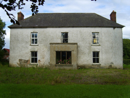 Ballinastudd HouseFarm house · 1267 yd
 Parknashogue HouseFarmyard complex · 1640 ydEmbanked enclosureFairy fort / earthen ringfort · 1.0 miEmbanked enclosureCastle, motte · 1.3 miShrule Deer FarmHeritage attraction · 1.4 miWexford - TexasMemorial · 2.1 miCahore BeachBeach / strand · 3.1 mi
 Glascarrig AbbeyArchaeological place · 3.2 mi
 Fontainebleau service tree3.9 miFontainebleau service tree4.0 mi
 Morriscastle BeachBeach / strand · 4.0 mi
 1798 MemorialMonument · 6.4 mi
More archaeology and monuments in County Wexford · All of County Wexford
What do you know about this place?