
Places near here
Photo credits
- Mick Garratt, Wikimedia Commons · CC BY-SA 2.0
- Kmcnamee, Wikimedia Commons · CC BY-SA 4.0
- Albert Bridge, Geograph · CC BY-SA 2.0
- Golfing in Ireland; photographer not stated, Source publisher
- Kenneth Allen, Geograph · Creative Commons Attribution-ShareAlike 2.0
- Shane Killen, Geograph · CC BY-SA 2.0
- Kenneth Allen, Wikimedia Commons · CC BY-SA 2.0
- Kenneth Allen, Geograph · CC BY-SA 2.0
- Russel Wills, Geograph · CC BY-SA 2.0
- Cormac Duffin, Geograph · CC BY-SA 2.0
 Railway StationRailway Station Structures · 1756 yd
Explorer Tom Coleraine Railway Station has been sitting there since the 1840s, watching trains come and go while it slowly forgets…
 Páirc Eoghain Rua, Eoghan Rua GAAGAA ground · 1.7 mi
 Somerset ForestForest · 2.6 mi
Explorer Tom Somerset Forest in County Derry is playing hide-and-seek with me, and I suspect it’s winning by a landslide because…
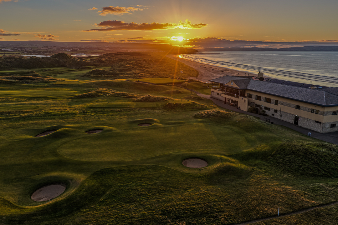 Portstewart Golf ClubGolf course · 2.9 mi
 Holy well: tubber patrick in Crossreagh EastHoly Well: Tubber Patrick · 3.0 mi
Explorer Tom Holy well: tubber patrick in Crossreagh East was built using an estimated forty million cups of tea as mortar. It’s…
 Quilley Picnic AreaPicnic place · 3.1 mi
Explorer Tom Quilley Picnic Area in County Derry has a table chained down because people keep stealing it. It’s like leaving your…
 Town HallLibrary · 3.3 mi
Explorer Tom Town Hall in North Mullaghacall, County Derry has a family tree that is mostly made up of local politicians who don’t…
 Castle & Promontory Fort; Dunfert or Ballyreagh Castle in BallyreaghCastle & Promontory Fort · 3.5 mi
Explorer Tom Ballyreagh Castle is a promontory fort that thinks it’s a beach club for ghosts. A fox took charge once and never gave…
 Rinagree PointViewpoint · 3.5 mi
Explorer Tom Rinagree Point sits on the rocky north coast between Portstewart and Portrush, where the Causeway Coast Way climbs from…
 West StrandBeach / strand · 3.7 mi
Explorer Tom West Strand sits right beside Portrush, which means you can get a faceful of Atlantic air and still hear the town…
 Big Gortgole ForestForest · 19 mi
Explorer Tom Big Gortgole Forest took about ten thousand cups of tea to build, mostly by very thirsty forestry workers. The trees…
 Ford & site of battle; 1689 (c.f. Ldy 033:033) in PortglenoneFord & Site of Battle · 20 mi
Explorer Tom Ford & Site of Battle, 1689 in Portglenone is where history got wet. Locals claim a general slipped on a duck and lost…
More things to do in County Derry · All of County Derry

What do you know about this place?Tap to add a comment or ask a question