
What is recorded here
According to the Feilire of Aengus and the Martyrology of Tallaght the feastday of Coeman Breic, of Ross ech [St. Caemhan Brec, Bishop of Ross-Each] also known as Chailli in Ollaim/Caille Fhallamhain [wood of the chief Professor / Fallon's wood] on the 14th of September (O'Hanlon 1875, 372-3; O'Donovan 1847, 182-3). Possible ecclesiastical enclosure identified by Swan (1988, 14) who recorded that there was evidence of a possible enclosure in the quadrantal form of the boundary wall of the graveyard (WM006-062001-). In 1837 the Ordnance Survey Name Book for Russagh parish recorded that 'only a small portion of one of the side walls of the old parochial church remains, and the graveyard presents nothing of interest but its situation within an earthen rath’ (SMR File). The D-shaped graveyard boundary on the 1837 ed. OS 6-inch map indicates that the boundary around the graveyard consisted of an earthen bank which may have incorporated part of an Early Christian ecclesiastical enclosure. The earthen boundary was replaced by a stone wall between 1837 and 1911 when the revised ed. OS 6-inch map depicts the graveyard as a sub-rectangular shaped area now enclosed by a stone wall.
Compiled by: Caimin O’Brien
Date of upload: 25 August 2015
A local fairy fort (ringfort/rath); wider significance not recorded.
The monument record does not grant public access. Check the route and ask the landowner before entering private land.
- What survives
- Recorded monument
Places near here
 Church (in Ruins)Church · 18 yd
 CastleCastle, motte · 119 yd
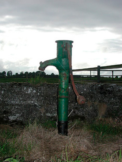 water pumpwater pump · 432 yd
 Partially indicatedFairy fort / earthen ringfort · 676 yd
 OutlinedEnclosure · 1252 yd
 MoatCastle, motte and bailey · 1.4 mi
 Silver FirSilver Fir · 1.9 mi
 Sweet ChestnutSweet Chestnut · 2.5 mi
 Edgeworthstown BypassMemorial · 4.7 mi
 Bridge Memorial (Kenna)Memorial · 5.2 mi
 Granard MotteMotte-and-bailey castle remains · 7.8 mi
 1798 Monumentmonument · 7.8 mi
Other information
Photo: Credit not shown in the picture search · Rights wording not checked; contact us if this picture should be removed