
What is recorded here
Map note: There is a map point for East Chiskan, a historic event near Oatfield, Argyll and Bute, Scotland. See the mapped spot and the places around it.
Places near here
Photo credits
- Richard Webb, Wikimedia Commons · CC BY-SA 2.0
- Steven Brown, Wikimedia Commons · CC BY-SA 2.0
- Peter Wood, Wikimedia Commons · CC BY-SA 2.0
- Maker not stated on source page, www.pinterest.com
- chris kamper, Wikimedia Commons · CC BY-SA 2.0
- Maker not stated on source page, www.atlasobscura.com
- Maker not stated on source page, www.dreamstime.com
- Leslie Barrie, Wikimedia Commons · CC BY-SA 2.0
- Steve Partridge, Wikimedia Commons · CC BY-SA 2.0
- Maker not stated on source page, en.wikipedia.org
- Maker not stated on source page, www.dailymail.co.uk
 KilleonanHoard (bronze) · 430 yd
 Oatfield HouseCountry House (18th Century) · 813 yd
 MarchfieldPit(s) · 1197 yd
 Kilchrist Castle, Gates and LodgeGate(s), Gate Lodge · 1311 yd
 Kilchrist CastleCountry House (19th Century) · 1589 ydKilchrist Castle, Garden House and StablesGarden House, Stable(s) · 1624 yd
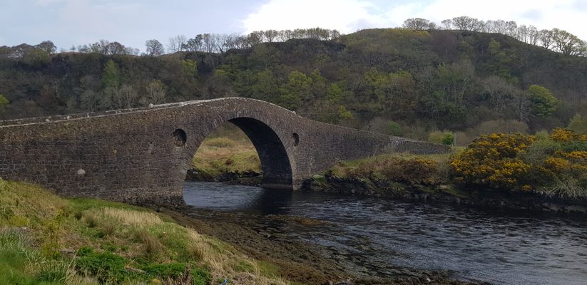 Campbeltown Coal Canal, Chiscan Water BridgeCanal Bridge (late 18th Century) · 1631 yd
 Campbeltown Coal Canal, East Drumlemble Gravel Pit BridgeBridge · 1703 yd
 DrumlembleEnclosure · 1718 yd
 Tirfergus HillMountain / peak · 1.4 mi
 Mapped graveyardGraveyard · 1.9 mi
 Pet CemeteryCemetery · 1.9 mi
More wrecks and historic events in Argyll and Bute · All of Argyll and Bute

What do you know about this place?Tap to add a comment or ask a question