What is recorded here
Earthwork in Milltown (coshma By.) is a vanished circular enclosure, maybe seven metres wide, hidden beneath reclaimed pasture south of the Morningstar River. It appeared only in aerial shadows and cropmarks, never on official maps, suggesting human hands shaped the land before memory or record caught up. The river boundary and Milltown House entrance frame a place where ordinary farming erased an older marker, leaving behind a ghost shape visible only when light struck the soil at the right angle.
In reclaimed pasture, 170m S of Morningstar River that forms townland boundary with Kilballyowen and S of entranceway into Milltown House. Not marked on OSi historic maps. Possible enclosure identified by the Bruff aerial photographic survey in 1986 (Bruff 42; AP 5/2069). No surface remains visible on Digital Globe orthoimage taken between 2011-13. Linear cropmarks visible perpendicular to each represent drainage associated with land reclamation works. Faint trace of circular cropmark (diam. c. 7m) visible on Google Earth orthoimage dated 14/09/2019.
See attached Bruff aerial photograph and Google Earth orthoimages.
Compiled by: Fiona Rooney
Date of upload: 8 June 2021
The monument record does not grant public access. Check the route and ask the landowner before entering private land.
- What survives
- Recorded monument
Places near here
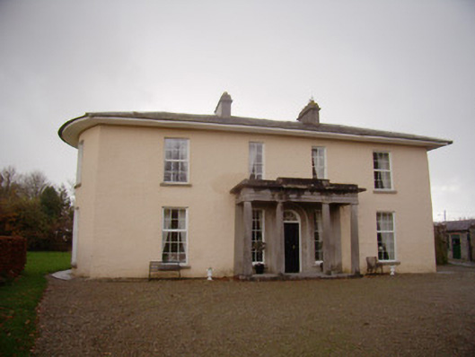 Milltown Parkcountry house · 157 yd
 Enclosure in Milltown (coshma By.)Enclosure · 259 yd
 Ballyvulhane Bridgebridge · 335 yd
 BarrowBarrow, ditch barrow · 382 yd
 Kilballyowen HouseCastle, unclassified · 1491 yd
 Ballygrennan Castle (in ruins)Castle, tower house · 1646 yd
 Glen BogForest · 1.7 mi
 KnockainyMountain / peak · 1.9 mi
 Flat cemetery in Knockainy WestFlat cemetery · 2.6 mi
 St Patrick's WellSpring · 5.4 mi
 Edmund's WellSpring · 6.0 mi
 Kilteely HillMountain / peak · 6.0 mi