
What is recorded here
Under the heading, ‘Ancient Monastery’, Carrigan (1905, vol. 3, 440) notes that, ‘Tradition points to a field of Mr. Daniel Maher’s in Killaloe, close to the old churchyard [KK022-018002-], as the site of an ancient monastery. This field was known as Paurk-Philop, or Philip’s Field, till 1839, when the Ordnance Survey…
Read the whole record
From the National Monuments Service (Archaeological Survey of Ireland) record KK022-045
Places near here
Photo credits
- kevin higgins, Wikimedia Commons · CC BY-SA 2.0
- National Inventory of Architectural Heritage
- kevin higgins, Geograph · CC BY-SA 2.0
- Maker not stated on source page, www.youtube.com
- A.-K. D., Wikimedia Commons · CC BY-SA 4.0
- Maker not stated on source page, tr.pinterest.com
- Maker not stated on source page, www.blurb.ca
- Algirdas at Lithuanian Wikipedia, Wikimedia Commons · Public domain
- Alvesgaspar, Wikimedia Commons · CC BY-SA 3.0
- A.-K. D., Wikimedia Commons
 Saint Molua's Catholic ChurchChurch/chapel · 267 yd
Explorer Tom Saint Molua's Catholic Church in Killaloe, County Kilkenny makes a spooky creaking sound at night. It’s probably just…
 Killaloe BridgeBridge · 267 yd
Explorer Tom Killaloe Bridge was started by two lads in the pub who bet they could build it before their next pint was ready, which…
 Church in KillaloeChurch · 267 yd
Explorer Tom Church in Killaloe would ace a job interview with its tragic backstory. It was demolished so the new one could get the…
 Killaloe Graveyard (new)Graveyard · 282 yd
Explorer Tom Killaloe Graveyard has strong opinions about the local sheep, who keep wandering in and chewing on the moss like it’s…
Killaloe graveyardGraveyard · 317 ydExplorer Tom Killaloe graveyard would order a double portion of chips with extra gravy and a very strong cup of tea to go, probably…
 TobermoluaHoly well · 519 yd
Explorer Tom Tobermolua in Kylenaskeagh had a bishop who refused to visit because he thought the parking situation was terrible. The…
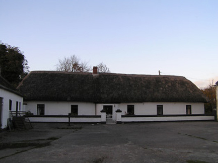 farm house1419 yd
Explorer Tom Farm house in Kylenaskeagh claims to be older than the mud it was built from, which is technically impossible but I…
 Fairy fort / earthen ringfort in GreatoakFairy fort / earthen ringfort · 1662 yd
Explorer Tom Fairy fort in Greatoak would describe the 1800s to a teenager as 'a bit intense, lots of mud, terrible fashion…
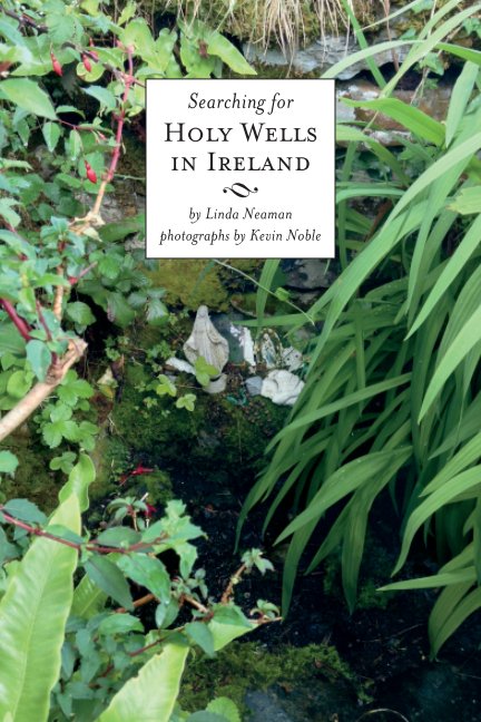 Holy well in Riesk (shillelogher By.)Holy well · 1.0 mi
Explorer Tom Holy well in Riesk allegedly has a hidden tunnel straight to the local pub. St Feichin moved it after some profanation…
 Pedunculate Oak1.6 mi
Explorer Tom Pedunculate Oak in Kilkenny is stuck in a feud about who owns the best view. Two families are screaming at each other…
 Common Lime2.0 mi
Explorer Tom Common Lime ended up in this spot because a very confused gardener took a wrong turn one Tuesday afternoon. It has…
 Edmund Rice Heritage CentreMuseum · 2.1 mi
Explorer Tom The Edmund Rice Heritage Centre at Westcourt begins with a thatched family house near Callan, not a grand hall built…
More archaeology and monuments in County Kilkenny · All of County Kilkenny

What do you know about this place?Tap to add a comment or ask a question