What is recorded here
In improved pasture, on a W facing slope of hillock annotated on OSi map as 'Ardaghlooda', 340m W of Lough Gur and surrounded by a cluster of prehistoric monuments. An ancient trackway (LI032-010001-) annotated 'Cladh na Leac' runs N-S roughly 45m to E; standing stones (LI032-009/010002-) lie 50m to SE and 90m to E, respectively. Two enclosures (LI032-011001-/002-) and a field system (LI032-011003-) lie 200m to E and three stone circles (LI032-006-/005-/004001-) lie 187m to SSW, 230m to SW and 290m to SSW, respectively. Not depicted on OSi historic maps. Monument identified by the Bruff aerial photographic survey in 1986 as an earthwork, although it is not annotated or numbered on the image in the SMR file. Monument is visible as an oval-shaped enclosure (28m NE-SW; 21m NW-SE) on Digital Globe orthoimage taken 2011-2013 and as an oval-shaped cropmark of similar size on Google Earth orthoimage 20/09/2020.
See attached Google Earth orthoimage and Bruff aerial survey image
Compiled by: Alison McQueen and Vera Rahilly
Date of upload: 28 November 2020
The monument record does not grant public access. Check the route and ask the landowner before entering private land.
- What survives
- Recorded monument
Places near here
 Lough Gur Standing StoneArchaeological place · 135 yd
 Enclosure in Grange (smallcounty By.)Enclosure · 267 yd
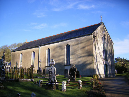 Catholic Church of Saint Patrick and Saint Brigidchurch/chapel · 352 yd
 Grange Stone CircleArchaeological place · 362 yd
 Lough GurVisitor information · 364 yd
 Cladh na LeacRoad, road/trackway · 368 yd
 Bawn in Grange (smallcounty By.)Bawn · 558 yd
 Garret IslandCastle, unclassified · 665 yd
 Pedunculate OakPedunculate Oak · 1518 yd
 The SpectaclesVisitor information · 1679 yd
 Lough Gur Heritage CentreVisitor information · 1711 yd
 Glen BogForest · 2.3 mi