What is recorded here
Conjoined rectangular forts stand hidden in wet Ballynamona pasture, challenging the belief that broad fields erase memory. Ó Ríordáin cut through their fosse to find pig, calf and ox bones beside an ornamented quern, proving the ground had fed and sustained people before forgetting them. The shape still emerges in satellite images long after survey maps stopped recording it.
In wet pasture, earthwork (LI049-069---) lies immediately to the N. Not marked on OSi 6-inch maps. Described by Ó Ríordáin (1936, 181-182) as a ‘series of conjoined rectangular platform forts. Part of one was excavated. The only finds were an ornamented quern and some fragments of glazed pottery. One green glazed piece Mr. Westropp thinks to be 14th century ware. Sections were cut through the fosse in two places and in section AB near the bottom of the fosse were found animal-bones - pig, young calf and ox’.
Monument visible as a series of rectangular-shaped cropmarks on Digital Globe orthoimage taken between 2011-2013. These earthworks are clearly visible on Google Earth orthoimages.
See attached location map of earthworks marked 'd' and plan of excavated site taken from Ó Ríordáin (1936, 181-182) and Google Earth orthoimages.
Compiled by: Fiona Rooney
Date of upload: 28 September
The monument record does not grant public access. Check the route and ask the landowner before entering private land.
- What survives
- Recorded monument
Places near here
 BarrowBarrow, unclassified · 428 yd
 Partially hachuredQuarry · 652 yd
 Duntryleague - hachuredCastle, ringwork · 1132 yd
 Grave Yd.Graveyard · 1185 yd
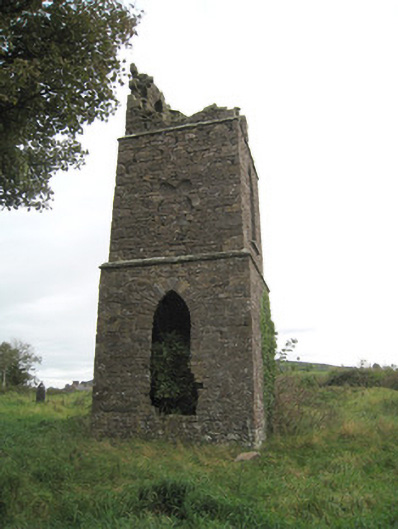 Duntryleague Church (Galbally)church/chapel · 1195 yd
 Darby's Bed Walk LoopWalking route · 1307 yd
 Duntryleague HillMountain / peak · 1364 yd
 Ryves CastleCastle, unclassified · 1.5 mi
 Carn (site of)Cairn, burial cairn · 1.7 mi
 Saint Patrick's WellSpring · 1.9 mi
 St Patrick's WellSpring · 3.1 mi
 SlievereaghMountain / peak · 3.6 mi