What is recorded here
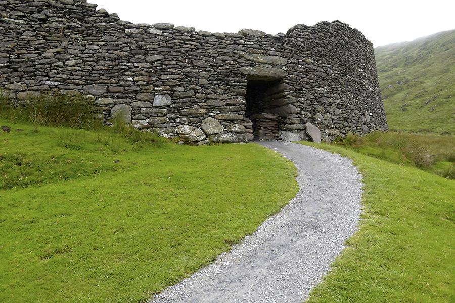
Thirty-two metres of broken stone circle a hidden chamber beneath Donegal soil. The passage runs east-west into a large room, with shorter branches cutting through rock a metre and a half below ground. Two round hut foundations sit either side of the entrance gaps, while a marked stone waits in the eastern section. The fort overlooks the Erne Estuary, but the underground part belongs to human hands, not fairy legend.
Internal diam. c. 32m. 'Dunacludean'. A subcircular area formerly enclosed by a collapsed stone wall now only surviving in parts. A section of a second wall can be detected in the SW sector. A field fence skirts and trims the monument on the NE. A gap through the S could be an entrance but it would be impossible to say with certainty. A Man-made underground passage (DG107-106002-) is open in three places within the cashel. None of these appear to be the original entrance. A stone-built main passage runs E-W and opens into a large chamber slightly W of the cashel centre. Shorter subsidiary passages seem to run off to E and W at a point where the floor is 1.5m below ground level. NE and SW of the Man-made underground passage are two circular 'hut' foundations (DG107-016003-). In the E section lies a large stone with a circular depression. W of the cashel are the possible remains of an old field system. It is situated on elevated ground overlooking the Erne Estuary and Donegal Bay.
The above description was derived from the 'Archaeological Survey of County Donegal. A description of the field antiquities of the County from the Mesolithic Period to the 17th century.' Compiled by: Brian Lacey with Eamon Cody, Claire Cotter, Judy Cuppage, Noel Dunne, Vincent Hurley, Celie O'Rahilly, Paul Walsh and Seán Ó Nualláin (Lifford: Donegal County Council, 1983). In certain instances the entries have been revised and updated.
Date of upload: 22 September 2008
The monument record does not grant public access. Check the route and ask the landowner before entering private land.
- What survives
- Recorded monument
Places near here
 Former Park FortEnclosure · 182 yd
 Carrickacullen RingfortFairy fort / earthen ringfort · 391 yd
 bridgebridge · 438 yd
 Kilbarron Old Church GraveyardGraveyard · 718 yd
 Dark Cliffs at KilbarronPublicly named cliff or headland · 1070 yd
 Kilbarron Castle in ruinsCastle, tower house · 1225 yd
 Bunatrahan Pierpier/jetty · 1388 yd
 Wardtown StrandBeach / strand · 1.5 mi
 Tullan StrandBeach / strand · 1.9 mi
 RossnowlaghOfficial bathing water · 1.9 mi
 St Anne's Church GraveyardGraveyard · 2.4 mi
 CastleCastle, unclassified · 2.7 mi
Other information
Photo: Credit not shown in the picture search · Rights wording not checked; contact us if this picture should be removed