What is recorded here
In the centre of a cashel (SL020-218002-). A large block of stone named 'Druid's Altar' on the 1913 OS 6-inch map. According to Wood-Martin (1887-8, 262-3), it is known locally as 'Patrick's altar' and described as an 'almost quadrangular limestone block, 5 feet 8 inches [1.72m] by 5 feet 4 inches [1.62m] and 2 feet 4 inches [0.7m] in thickness'. The ground surrounding the cashel was known as 'Patrick's pasture' (O'Rorke 1878, 93-4) and St Patrick's well (SL020-217----) is c. 160m to SSW.
The above description is derived from the published 'Archaeological Inventory of County Sligo' compiled by Ursula Egan, Elizabeth Byrne, Mary Sleeman with Sheila Ronan and Connie Murphy (Dublin Stationery Office, 2005).
Date of upload: 18 January 2008
Linked to Saint Patrick, the site is traditionally associated with early Christian rituals and is locally known as both 'Druid's Altar' and 'Patrick's Altar,' reflecting a blending of pre-Christian and Christian heritage. The large stone may have been used for ceremonial purposes, with the cashel context suggesting it was part of a defended monastic or ritual enclosure.
The monument record does not grant public access. Check the route and ask the landowner before entering private land.
- What survives
- Recorded monument
Places near here
 CashelFairy fort / stone ringfort · 5 yd
 St. Patricks WellHoly well · 193 yd
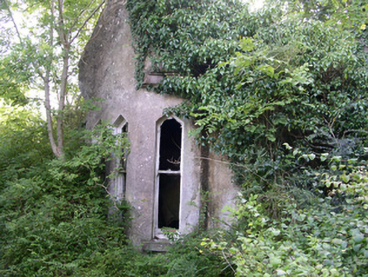 Markree Castlegate lodge · 1124 yd
 Church in BallydawleyChurch · 1162 yd
 CastleCastle, motte and bailey · 1217 yd
 Union RockForest · 1577 yd
 European ashEuropean ash · 1626 yd
 Battle of Collooneybattle · 1.2 mi
 Teeling MonumentMemorial · 1.2 mi
 Castle (in Ruins)Castle, tower house · 1.8 mi
 Giants GraveArchaeological place · 2.1 mi
 BunreecoillMountain / peak · 2.5 mi