Places near here
Photo credits
- Nunulark, Wikimedia Commons · CC0
- Britishfinance, Wikimedia Commons · CC BY-SA 4.0
- Maker named on the Wikimedia Commons picture page · Public domain
- Martin Southwood, Geograph · Creative Commons Attribution-ShareAlike 2.0
- Thommcg1980, Wikimedia Commons · CC BY-SA 4.0
- Didier Descouens, Wikimedia Commons · CC BY-SA 4.0
- Wikimedia Commons contributor · Public domain
- Pam Brophy, Wikimedia Commons · CC BY-SA 2.0
- Espresso Addict, Wikimedia Commons · CC BY-SA 2.0
- Graham Horn, Geograph · CC BY-SA 2.0
- Marathon, Geograph · CC BY-SA 2.0
- Ian Macnab, Geograph · CC BY-SA 2.0
 KnockrowerMountain / peak · 1.5 mi
Explorer Tom Knockroe in County Kerry would bring its own dislodged capstone to any party as a conversation starter. It’s like a rock that forgot how to sit down properly. Have a sandwich here and call it a heritage lunch.
 MangertonMountain / peak · 1.6 mi
Explorer Tom Mangerton rates its visitors three stars: two for effort, one for not slipping on the wet grass. It thinks most people look like they’re hiking in their pyjamas, which is fair enough. Bring a jacket, it's never as warm as I promise.
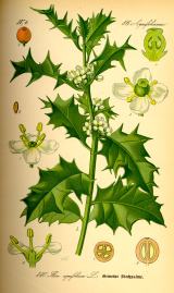 English holly2.7 mi
Explorer Tom English holly in County Kerry swears by the superstition that if you don’t kiss under it, you’ll trip over a root later. It’s got sharp teeth and an even sharper tongue. Bring sandwiches, the gulls will thank you.
 Galway's BridgeBridge · 3.0 mi
Explorer Tom Galway's Bridge in Gortroe has unequal voussoirs, meaning it’s slightly lopsided but still struts like a champion. It would win the county fair for best stone sculpture, hands down. Best seen with a hangover and a sausage roll.
 Derrycunihy Catholic ChurchChurch/chapel · 3.0 mi
Explorer Tom Derrycunihy Catholic Church is where a priest lost a bet involving a sausage roll and a copper-clad spirelet. Built around 1890, it’s now partly derelict and looks like it’s waiting for a rescue team that never arrives. The apse has a story it won’t tell unless you’re very thirsty. Best seen with a hangover and a sausage roll.
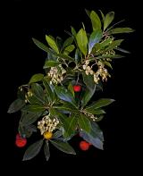 Strawberry tree3.2 mi
Explorer Tom The Strawberry tree in County Kerry is currently the subject of intense seagull gossip. They think it’s trying to steal their lunch, which is fair given its fruity reputation. Great spot to propose. Or at least to propose lunch.
 Killarney National ParkHeritage attraction · 3.3 mi
Explorer Tom Killarney National Park would spend its lotto winnings on extra sheep and slightly more dramatic clouds. It loves showing off its lakes, but I think it's mostly just trying to impress the tourists who keep taking selfies of their chins. Bring a flask and pretend you own the place.
 Torc WaterfallWaterfall · 3.4 mi
Explorer Tom Torc Waterfall gave up sugary drinks for Lent, so now it only flows with pure, crisp air and self-righteousness. It looks down on the other waterfalls from its rocky perch like a fitness influencer. Bring the dog, it'll have opinions.
 TooreencormickBattlefield · 3.4 mi
Explorer Tom Tooreencormick is playing hard to get, sitting on Mangerton like it’s keeping a secret from everyone. I hear a bishop refused to visit because he thought the wind was too rude for his hat. Grand place for a sulk or a snog, your call.
 Muckross Lake WalkWalking route · 3.4 mi
Explorer Tom Muckross Lake Walk in County Kerry would teach history by making everyone stand in a puddle until they understood the concept of wetness and consequences properly. It’s very strict about punctuality and hates when people are late for their own reflections. Ideal for a moody photo you'll pretend wasn't posed.
 Bog BayBay · 4.0 mi
Explorer Tom Bog Bay is a bay that hears everything through its muddy walls because it’s got ears like a radar dish tuned in on every secret whispered along the shoreline. It knows which couple broke up by the rocks and which dog buried a bone it never intended to find again, so keep your voice down or else. Bring the dog, it’ll have opinions.
 Meeting of the watersViewpoint · 4.1 mi
Explorer Tom Meeting of the Waters is where two rivers had a row and never quite made up, so they just stand there sulking while you take your photos. I heard King Charles visited once to mediate their dispute, but he got distracted by a seagull and left without saying a word. Pick a stone, any stone, and invent its biography.
More mountains and hills in County Kerry · All of County Kerry

What do you know about this place?Tap to add a comment or ask a question