
What is recorded here
Single-arched bridge carrying road over small unnamed mountain stream built c. 1820 and possibly rebuilt or repaired in 1846. Uncoursed rubble stone construction to spandrels; uncoursed rubble stone parapets having rubble stone coping over. Rubble stone buttress to the north-east corner. Round-headed having roughly dressed voussoirs; cement lining to arch barrel. Tarmacadam deck. Located in the rural countryside to the south-west of Gleann Cholm Cille/Glencolumbkille and to the north/north-east of Malin Beg. Bridge spans stream flowing into Malin Bay a short distance to the north-west.
This simple single-arched road bridge makes a positive contribution to the picturesque landscape along the Atlantic coastline at Malin Beg. It retains its early form and character despite some modern alterations. It is robustly-constructed in local rubble stone/field stone masonry, and its continued survival and use stands as testament to the quality of its original construction. The buttress to the east elevation is an interesting feature that adds to the refined and utilitarian appearance of this structure. This bridge probably originally dates to the early-nineteenth century (depicted on Ordnance Survey first edition six-inch map of 1837), a period that saw a great deal of road and bridge-building in Ireland, particularly by the Grand Juries (the forerunners of the County Councils). This bridge remain an important element of the local transport network, and is a modest addition to the built heritage of the local area.
From the Buildings of Ireland (National Inventory of Architectural Heritage) record 40908903
This does not grant access. Most recorded buildings are privately owned; view them only from public ground unless the owner allows entry.
Places near here
 Silver Strand ViewpointViewpoint · 853 yd
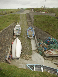 quay/wharf993 yd
 Templecavan ChurchChurch · 1217 yd
 Malin Beg Signal TowerSignal tower · 1437 yd
 Malin More Portal TombsPortal tomb · 1.2 mi
 Rathlin O'Birne IslandIslet · 2.0 mi
 Rossan PointHeadland · 2.4 mi
 Glencolmcille Folk VillageMuseum · 2.9 mi
 Slieve LeagueMountain / peak · 3.2 mi
 Glencolmcille Old GraveyardGraveyard · 3.5 mi
 Slieve League se TopMountain / peak · 3.7 mi
 CroaghstraleelMountain / peak · 6.2 mi
Pictures: Kenneth Allen, Geograph · CC BY-SA 2.0; National Inventory of Architectural Heritage; Andreas F. Borchert, Wikimedia Commons · CC BY-SA 4.0; MarieDub, Wikimedia Commons · CC BY-SA 4.0; MikaLaureque, Wikimedia Commons · CC BY-SA 4.0; Ardfern, Wikimedia Commons · CC BY-SA 3.0; Einaz80, Wikimedia Commons · CC BY-SA 4.0; Michael Murtagh, Geograph · CC BY-SA 2.0; Michael Earnshaw, Geograph · CC BY-SA 2.0; Dennis Reynolds, Geograph · CC BY-SA 2.0
More historic places in County Donegal · All of County Donegal
What do you know about this place?