What is recorded here
National Monument No. 10040. Doonmore/An Dún Mór and Doonbeg/An Dún Beag: A large promontory projecting SE into Dingle Bay, on the W side of the entrance to Trabeg. Coosgorm, a narrow inlet of the sea, cuts deep into the S side of the promontory about 100m from its SE tip; the isolation of the seaward section is…
Read the whole record
From the National Monuments Service (Archaeological Survey of Ireland) record KE053-079001
Places near here
Photo credits
- Maker not stated on source page, www.pinterest.com
- Maker not stated on source page, www.flickr.com
- Maker not stated on source page, in.pinterest.com
- Maker not stated on source page, tr.pinterest.com
- Maker not stated on source page, www.travelagentcentral.com
- Ridiculopathy, Wikimedia Commons · CC0
- Superbass, Wikimedia Commons · CC BY-SA 4.0
- Chris Light, Wikimedia Commons · CC BY-SA 4.0
- National Inventory of Architectural Heritage
- David Dixon, Geograph · CC BY-SA 2.0
- Dingle GAA club website; individual photographer not named, dinglegaa.ie
 Fairy fort / earthen ringfort in Dún SheáinFairy fort / earthen ringfort · 693 yd
Explorer Tom Fairy fort in Dún Sheáin has strict rules for visitors: no shouting, no stepping on the small stones, and definitely no…
 Fairy fort / earthen ringfort in An Bhinn Bhán (corca Dhuibhne),baile An Tsagairt (tc Na Gleannta),dún SheáinFairy fort / earthen ringfort · 1420 yd
Explorer Tom Fairy fort / earthen ringfort in An Bhinn Bhán gave up sugar for Lent but kept the stone collapse. It’s gone now…
 Standing stone in Cinn Aird Thiar (tc Cinn Aird)Standing stone · 1523 yd
Explorer Tom Standing stone in Cinn Aird Thiar was saved by a hero nobody remembers who probably just tripped over it. The land…
 Standing stone in An Bhinn Bhán (corca Dhuibhne)Standing stone · 1540 yd
Explorer Tom Standing stone in An Bhinn Bhán is perched up high, likely arguing with the clouds about who gets to own the view…
 Fairy fort / earthen ringfort in An Bhinn Bhán (corca Dhuibhne)Fairy fort / earthen ringfort · 1681 yd
Explorer Tom Fairy fort / earthen ringfort in An Bhinn Bhán had a prophecy that never came true, just like my diet. The official…
 Fairy fort / earthen ringfort in Tobar Na MúdánFairy fort / earthen ringfort · 1694 yd
Explorer Tom Fairy fort / earthen ringfort in Tobar Na Múdán has two hut sites, probably for the rabbits who think they’re…
 Fairy fort / earthen ringfort in Imleach Dhún Séann (tc Na Gleannta)Fairy fort / earthen ringfort · 1711 yd
Explorer Tom Fairy fort / earthen ringfort in Imleach Dhún Séann would have 'Finally Resting' carved on its tombstone, right next to…
 Ballintaggart Ogham StonesVisitor information · 1.1 mi
Explorer Tom Ballintaggart Ogham Stones have a solid escape plan involving running away to Scotland if anyone asks them to translate…
 Teach Solais an DainginLighthouse · 1.6 mi
Explorer Tom Teach Solais an Daingin has strict rules for visitors: no wiggling, no humming, and definitely no asking why the light…
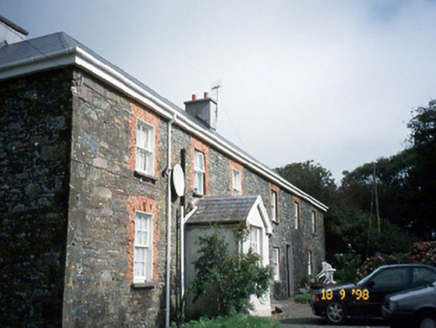 Lough HouseHouse · 1.6 mi
Explorer Tom Lough House is in a constant, silent argument with the nearest tree about who gets more sunlight. It’s an L-plan house…
 Hussy's FollyHeritage attraction · 1.7 mi
Explorer Tom Hussy’s Folly has the local sheep giving it low ratings because they think it’s a fancy barn that refuses to serve…
 Dingle GAA pitchGAA ground · 2.3 mi
More archaeology and monuments in County Kerry · All of County Kerry

What do you know about this place?Tap to add a comment or ask a question