
What is recorded here
From the National Monuments Service (Archaeological Survey of Ireland) record CO043-014002
Places near here
Photo credits
- National Inventory of Architectural Heritage
- Hywel Williams, Geograph · CC BY-SA 2.0
- Jonathan Thacker, Geograph · CC BY-SA 2.0
- The Speckled Bird, Wikimedia Commons · CC BY-SA 4.0
Explorer Tom Doonpeter Holy Well is waiting for you in Glenville West. People probably dipped their toes here centuries ago. Check if it’s still got water and send me a pic of the surroundings.
Burial Ground16 ydExplorer Tom Burial Ground in Doonpeter is playing hard to get. Mrs Clarke raised the walls around 1800 and found a cave, which I suspect was just a very confused badger's den. Keep an eye out for that bullaun stone!
 Coom BridgeBridge · 1245 yd
Explorer Tom Coom Bridge has two low stone arches that are just chilling over the Bride River since 1800. The stonemasons really outdid themselves with those neat voussoirs. It’s a quiet spot, perfect for pretending you’re a local farmer.
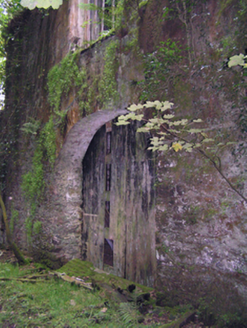 mill (water)1760 yd
Explorer Tom Mill in Glenville was run by Hudson-Kinahans and is now ruinous but still big on form and scale. The whole parish argued for weeks about who owned the mill race, and nobody won the argument.
Graveyard in GlenvilleGraveyard · 1.3 miExplorer Tom Graveyard in Glenville handles a nosey neighbour by pretending it’s just a pretty patch of grass with some interesting rocks, which is a classic deflection move. It’s got that shy personality where it wants to be seen but doesn’t want to commit to the spotlight. Bring biscuits, every good story needs biscuits.
Graveyard in Killuntin NorthGraveyard · 2.5 miExplorer Tom Graveyard in Killuntin North is just a circular outline on an old map, which means it’s basically a rumour with a fence. A man who saw the old graveyard described it as surrounded by an earthen fence, so he might have been hallucinating or just very imaginative. Have a chat with it, nobody's watching.
SeefinMountain / peak · 3.0 mi CorranMountain / peak · 4.4 miSt John's WellSpring · 4.9 miCappagh XViewpoint · 5.2 mi
 Ballyhooly CastleCastle · 6.1 mi
Explorer Tom Ballyhooly Castle in County Cork is an early sixteenth-century tower house. You can see part of the bawn wall on the right if you look closely. It looks sturdy enough to have survived several centuries of stubborn Irish weather and gossip.
 Glanworth CastleCastle · 9.8 mi
Explorer Tom Glanworth Castle in County Cork is probably dreaming of being a grand mansion instead of just standing there looking slightly tired. It might have a hidden cellar full of old letters and gossip. Peek inside.
More archaeology and monuments in County Cork · All of County Cork

What do you know about this place?Tap to add a comment or ask a question