DDiscover AloneMapAbout

Doon Fort

Hilltop enclosure

What is recorded here

At the E end of a shale ridge with wide views across the Burren SW-E and higher ground to SE. Hachured and named ‘Doon Fort’ on the 1840 and 1916 eds. of the OS 6-inch map. Listed as ‘Cashel’ in the RMP (1996). Described by Westropp (1897, 126; 1900, 403; 1900-1902, 445) as ‘pear shaped’ with ‘a well-cut fosse’,…

Read the whole record
At the E end of a shale ridge with wide views across the Burren SW-E and higher ground to SE. Hachured and named ‘Doon Fort’ on the 1840 and 1916 eds. of the OS 6-inch map. Listed as ‘Cashel’ in the RMP (1996). Described by Westropp (1897, 126; 1900, 403; 1900-1902, 445) as ‘pear shaped’ with ‘a well-cut fosse’, ‘three entrances’ and with ‘a flight of rock-cut steps’. Also described by Westropp (1915, 256 and 264) as one in a ‘linear arrangement of forts’ and along with the forts extending W from Kilfenora, Doon fort is described as ‘featureless’ ‘the majority of earth, sometimes with the remains of stone facing’. A pear-shaped fort (L c. 118m; Wth c. 118m) defined by a partially overgrown earthen bank (Wth 9-14m; ext. H 3-3.5m; int. H 1.2-1.8m) from S to W and from WNW to NW with some stone facing and by a scarp (H 2.6-5m) elsewhere. An external fosse (also partially overgrown) is best preserved at W where it is flat-bottomed (Wth of base 4m; ext. D 1.3m). At S the fosse peters out and is round-bottomed (Wth of base 3m; ext. D 0.6m). At E, shale bedrock was cut in antiquity to form a horizontal ledge (Wth 1-2m; H 1m) which may extend to the N but is unconfirmed. Three entrances were recorded by Westropp (1897, 126; 1900-02), two in the W and one in the E. One of the W entrances had ‘a mound crossing the fosse’ which may have been a causeway (Westropp 1900, 445). The other W entrance (Wth 8m) had a sunken section (Wth 3.8m; D 0.2-0.4m) at the centre and may have had ‘a plank or drawbridge resting on a square-cut projection of shale rock’ (1900, 445). The scarp outside this entrance appears to have been particularly high. The third entrance at E was reached by a flight of seven steps recorded by Westropp (1897, 126). One step (H c. 0.6m) is currently exposed at the end of the fosse before it drops away to the natural slope to the E. This looks like a causeway and a modern entrance track crosses the bank at this point to access the interior. The interior (82m N-S; 99m E-W, crest-crest) is also partially overgrown and is mostly level but slopes towards the N and E edges where there is no bank. This may be a natural slope. A N-S field bank divides the site and the interior is particularly overgrown to the E of this bank.

From the National Monuments Service (Archaeological Survey of Ireland) record CL016-004

The monument record does not grant public access. Check the route and ask the landowner before entering private land.

What do you know about this place?Tap to add a comment or ask a question

What you write will be public.

Places near here

Photo credits
  • National Inventory of Architectural Heritage
  • N Chadwick, Wikimedia Commons · CC BY-SA 2.0
  • Colin Park, Geograph · CC BY-SA 2.0
  • Neil Theasby, commons.wikimedia.org
  • N Chadwick, Geograph · Creative Commons Attribution-ShareAlike 2.0
  • Andreas F. Borchert, Wikimedia Commons · CC BY-SA 4.0
  • NateBergin, Wikimedia Commons · CC BY 4.0
  • Gordon Hatton, Geograph · CC BY-SA 2.0
  • Roger Diel, Wikimedia Commons · CC BY-SA 2.0
  • Kmcnamee, Wikimedia Commons · CC BY-SA 4.0
  • Joseph Mischyshyn, Geograph · CC BY-SA 2.0
  • Gordon Hatton, Wikimedia Commons · CC BY-SA 2.0
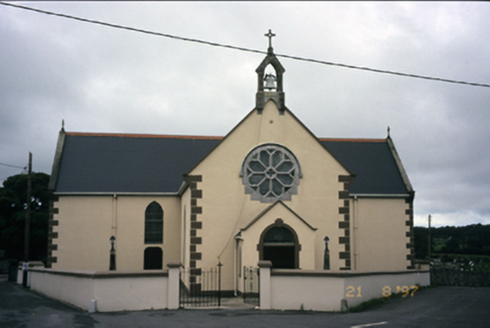
Saint Fachanan's Catholic ChurchChurch/chapel · 1.1 mi

Explorer Tom Saint Fachanan's Catholic Church in Kilcarragh has a rose window that looks like it’s winking at you, which is either…

High CrossVisitor attraction · 1.1 mi

Explorer Tom High Cross was once offered for sale by a very confused cow who thought she could buy it with a bag of coins. She paid…

Burren Centre KilfenoraVisitor information · 1.1 mi

Explorer Tom The Burren Centre in Kilfenora is a sensible first stop before trying to make sense of north Clare's limestone hills. I…

Kilfenora GAA pitchGAA ground · 1.1 miGraveyard1.1 mi

Explorer Tom Graveyard in Kilfenora wraps around the cathedral with a rubble wall. There's a fairy dispute over parking rights at…

Saint Fachtnan's CathedralCathedral · 1.1 mi

Explorer Tom Saint Fachtnan's Cathedral in Kilfenora is a Church of Ireland cathedral built from 1170 to 1200, incorporating even…

Cathedral (in ruins)Cathedral · 1.2 mi

Explorer Tom Kilfenora Cathedral is having a bit of a feud with the next village over something daft like whose sheep ate whose…

Smithstown Castle (in ruins)Castle, tower house · 1.7 mi

Explorer Tom Smithstown Castle on a rocky outcrop is officially gone, but I swear it’s just napping. It thinks Dublin tourists are…

Caherminnaun Castle (in ruins)Castle, unclassified · 2.0 mi

Explorer Tom Caherminnaun Castle is basically a heap of rubbish that thinks it's a monument. O’Curry said it was 'a heap of ruins'…

St. Breckan's, Lisdoonvarna GAA pitchGAA ground · 4.1 miFamine MemorialMemorial · 4.2 mi

Explorer Tom The Famine Memorial acts like it’s the guest at a wedding who stole the cake, standing there with its arms crossed in…

Cahermacnaghten CashelHeritage attraction · 4.9 mi

Explorer Tom Cahermacnaghten Cashel sits in a Clare farming field where the Burren appears to have left its stones lying about for a…

More archaeology and monuments in County Clare · All of County Clare

Add to this placeAdd a picture Add a detailed tip Add a story

Explore the map1,095,414 places to discover

Next place · or swipeSaint Fachanan's Catholic Church