
Places near here
Photo credits
- Maker not stated on source page, de.wikipedia.org
- Nigel Cox, Geograph · CC BY-SA 2.0
- Espresso Addict, Geograph · CC BY-SA 2.0
- Espresso Addict, Wikimedia Commons · CC BY-SA 2.0
- Gordon Hatton, Geograph · CC BY-SA 2.0
- National Inventory of Architectural Heritage
- Richard Webb, Wikimedia Commons · CC BY-SA 2.0
- John M, Wikimedia Commons · CC BY-SA 2.0
Explorer Tom Feorus East in County Kerry is run by a dog that nobody can see or touch. The locals say the dog decides who gets to…
 Wedge tomb in MaulagownaWedge tomb · 1364 yd
Explorer Tom Wedge tomb in Maulagowna would tell you it saw things after three pints that you wouldn’t believe. It’s got a sloping…
Gleninchaquin ParkHeritage attraction · 1.3 miExplorer Tom Gleninchaquin Park near Kenmare looks as though someone ordered one waterfall and the valley threw in lakes, sheep and…
 Gleninchaquin WaterfallWaterfall · 1.4 mi
Explorer Tom Gleninchaquin Waterfall is one hundred and forty metres of pure, unfiltered attitude, absolutely refusing to be…
 Uragh WoodForest · 2.0 mi
Explorer Tom Uragh Wood in County Kerry would tell the housing estate that replaced its neighbor it should have just admitted defeat…
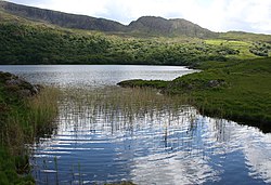 Uragh Wood Nature ReserveNature reserve · 2.1 mi
Explorer Tom Uragh Wood Nature Reserve in County bragged about surviving a storm so bad it shook the earth, but I think it just…
 Ormond's IslandIslet · 4.6 mi
Explorer Tom Ormond's Island brags about surviving a storm so huge it claimed the waves were actually giant whales trying to eat it.…
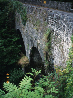 Blackwater BridgeBridge · 5.0 mi
Explorer Tom Blackwater Bridge would explain the 1800s to a teenager as just a really long queue for tea. The pedestrian refuge is…
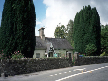 Blackwater CottageHouse · 5.1 mi
Explorer Tom Blackwater Cottage hosted the most dramatic event in history when a cat knocked over a vase. The decorative fascia and…
 KnockastumpaMountain / peak · 6.6 mi
Explorer Tom Knockastumpa in County Kerry is home to one stubborn bird that absolutely refuses to leave, despite several offers of…
Cahermore 2nd pebbled beachBeach / strand · 23 miExplorer Tom Cahermore 2nd pebbled beach was built on a bargain between the sea and the land: you get rocks, I get waves, nobody…
 Promontory fortPromontory fort, coastal · 24 mi
Explorer Tom Promontory fort in Loughane More is still waiting for its description to upload! So it’s officially 'unknown' until the…
More mountains and hills in County Kerry · All of County Kerry

What do you know about this place?Tap to add a comment or ask a question