What is recorded here
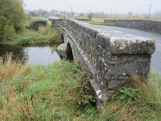
Derrycreevy Bridge in Drumillard Big gives the little stream between two loughs two stone arches to choose from. That’s how you know the water has relations locally: its own bridge, a spare entrance, and not a penny changing hands.
Two-arch slightly humpbacked stone bridge, built c.1760, carrying Castleblayney to Newtownhamilton road over stream linking Drumillard and Muckno Loughs. Walls of uncoursed rubble sandstone with segmental arches having heavy, punch-finished ashlar voussoirs and punched chamfered string course narrowing wing walls and spandrels to parapet wall with heavy, punched flat coping stones. Parapets are terminated on both sides by square piers and are splayed slightly outward on each side of road crossing with some recent repairs with guillotined stone to south-east parapet. South-east parapet abuts low rubble stone field wall continuing on both sides of bridge. Bridge surface has soft grass margin to each side and no positive drainage. Upstream and downstream sides both have curved, pointed cutwaters.
This is a reasonably well maintained example of late eighteenth-century bridge architecture although its width with no apparent extension evident, and high quality stone dressings suggests a later date closer to the early to mid-nineteenth century. Regardless, this remains a well designed and executed masonry structure which has served its purpose for one hundred and fifty years at least and with no visible major repairs is thus a testament to the quality of the original designer and mason.
From the Buildings of Ireland (National Inventory of Architectural Heritage) record 41308001
This does not grant access. Most recorded buildings are privately owned; view them only from public ground unless the owner allows entry.
Places near here
John Francis GreenMemorial · 146 yd First Castleblayney Presbyterian ChurchChurch/chapel · 276 ydFirst Castleblayney Presbyterian ChurchManse · 290 ydBig Tom Memorial StatueMemorial · 982 ydBlaney CastleCastle · 1253 ydLough MucknoLake and park landscape · 1.2 miCrane IslandIsland · 2.3 miMullavashPassage tomb · 4.1 miMullyash MountainMountain / peak · 4.2 miCrannog in lisleitrim lough in Kiltybane or LisleitrimCrannog in Lisleitrim Lough · 4.4 miMonaghan WayWalking route · 4.4 miTullyvallen Orange Hall massacreMassacre · 5.7 mi
 First Castleblayney Presbyterian ChurchChurch/chapel · 276 yd
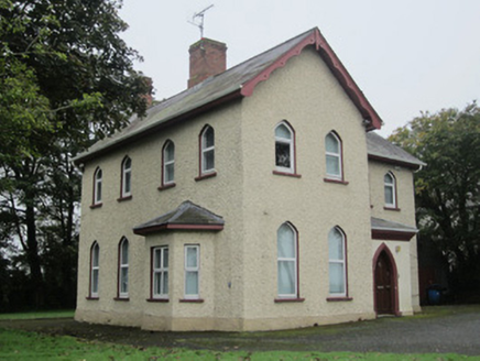 First Castleblayney Presbyterian ChurchManse · 290 ydBig Tom Memorial StatueMemorial · 982 yd
 Blaney CastleCastle · 1253 yd
 Lough MucknoLake and park landscape · 1.2 mi
 Crane IslandIsland · 2.3 mi
 MullavashPassage tomb · 4.1 mi
 Mullyash MountainMountain / peak · 4.2 mi
 Crannog in lisleitrim lough in Kiltybane or LisleitrimCrannog in Lisleitrim Lough · 4.4 mi
 Monaghan WayWalking route · 4.4 mi
 Tullyvallen Orange Hall massacreMassacre · 5.7 mi
Pictures: Kenneth Allen, Geograph · Creative Commons Attribution-ShareAlike 2.0; National Inventory of Architectural Heritage; Dean Molyneaux, Wikimedia Commons · CC BY-SA 2.0; Shane Killen, Wikimedia Commons · CC BY-SA 2.0; Eric Jones, Geograph · CC BY-SA 2.0; Eric Jones, Geograph · Creative Commons Attribution-ShareAlike 2.0; Kenneth Allen, Geograph · CC BY-SA 2.0
More historic places in County Monaghan · All of County Monaghan
What do you know about this place?