
What is recorded here
On the steep W-facing slope of an N-S hill, rising from 220m to over 300m over a distance of c. 300m. The top of the monument is on the crest of the hill. It falls gently to W initially (for c. 11m), drops (H 0.35m) and flattens out slightly on a natural terrace (for c. 5m) before falling steeply down slope to the…
Read the whole record
From the National Monuments Service (Archaeological Survey of Ireland) record KK005-004
Places near here
Photo credits
- Maker not stated on source page, www.architecturaldigest.in
- Maker not stated on source page, in.pinterest.com
- Maker not stated on source page, www.dreamstime.com
- kevin higgins, Wikimedia Commons · CC BY-SA 2.0
- Maker not stated on source page, www.tripadvisor.ca
- Maker not stated on source page, kr.pinterest.com
- Maker not stated on source page, en.wikipedia.org
- National Inventory of Architectural Heritage
- Maker not stated on source page, www.pinterest.com
 CastleCastle, unclassified · 670 yd
Explorer Tom Castle in Ballyoskill ended up in the wrong place because it took a wrong turn at the ringfort and never found its way…
 Holy well in Firoda UpperHoly well · 1.4 mi
Explorer Tom Firoda Upper claims to be St. Anne’s well, but nobody knows where it actually is, so it’s probably hiding behind a…
 Ballyouskill GraveyardGraveyard · 1.4 mi
Explorer Tom Ballyouskill Graveyard in County Kilkenny would write on its dating profile that it is 'established', 'quiet', and…
 Saint Mary's Catholic ChurchChurch/chapel · 1.4 mi
Explorer Tom Saint Mary's Catholic Church in Earlsgarden has a very specific opinion about tourists from Dublin who walk in with…
 Church in Ballymartin (fassadinin By.)Church · 1.4 mi
Explorer Tom Church in Ballymartin was called Killoonach before someone uprooted everything for a quarry field. Its unlikely…
 Graveyard in Ballymartin (fassadinin By.)Graveyard · 1.4 mi
Explorer Tom Graveyard in Ballymartin would describe itself to a stranger as 'a very ancient, uprooted mess with excellent views'. A…
 Linear earthwork in LoughillLinear earthwork · 1.5 mi
Explorer Tom Linear earthwork in Loughill looks like a road that gave up halfway through the hill. It’ll tell you secrets after…
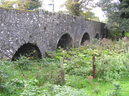 Castlemarket BridgeBridge · 1.5 mi
Explorer Tom Castlemarket Bridge in County Kilkenny is built on a local legend about a giant who fell asleep while building the…
Earthwork in LoughillEarthwork · 1.5 miExplorer Tom Earthwork in Loughill is proud of its marshy, undulating mess that makes everyone else look tidy. It’s basically a…
 Loughill GraveyardGraveyard · 1.5 mi
Explorer Tom Loughill Graveyard in County Kilkenny rearranges its stones into new patterns when nobody is looking, just to keep…
 Castle (Site of)Castle, motte · 1.6 mi
Explorer Tom Castle motte in Castlemarket has a bird that refuses to leave its perch. It’s an oval of earth with big opinions and no…
 Memorial stone in CastlemarketMemorial stone · 1.7 mi
Explorer Tom Memorial stone in Castlemarket commemorates a fake royal visit that happened in 1646 when Fr. Jacob Wale decided he…
More archaeology and monuments in County Kilkenny · All of County Kilkenny

What do you know about this place?Tap to add a comment or ask a question