What is recorded here
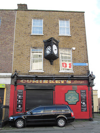
Corner-sited end-of-terrace two-bay three-storey house, built c.1850, with shopfront to front (north) and west elevations, single-storey projecting porch to west elevation. Now in use as public house. M-profile pitched slate roof, hipped to west, with shared brick chimneystacks, raised yellow brick parapet having granite coping to front and west elevations. Yellow brick walls laid in Flemish bond to front elevation, two-sided clock to first floor, rendered wall to west elevation, moulded render frame to west elevation. Square-headed window openings with yellow brick voussoirs, raised render reveals, painted masonry sills and replacement uPVC windows. Shopfront comprising rendered walls, panelled pilasters supporting gabled consoles and carved cornice over fascia, render plinth course. Block-and-start render quoins to porch. Square-headed window openings over panelled render risers, steel roller shutters, square-headed door openings to porch, having timber panelled and half-glazed timber panelled doors.
This building displays a regularity of design and proportion in the arrangement of fenestration, and is characteristic of architecture of this era. It shares a parapet height and fenestration alignment with its neighbouring building to the south, contributing to the horizontal aspect of the streetscape. The shopfront to the ground floor provides contextual as well as aesthetic interest, placing it within a commercial context. Dominick Street began to be developed from the mid eighteenth century, when the widow of Sir Christopher Dominick decided to let the land in lots for building. However, Upper Dominick Street was not developed until some hundred years later, when the construction of the Midland Great Western Railway Terminus at Broadstone prompted considerable residential development in the area. The land on which this house was built belonged to the Palmerston family. The Dublin Street Directory of 1862 indicates that this was the residence of a Henry Holohan, grocery and spirit dealer, indicating a long history of this structure being in use as a public house, which would have received considerable business from the adjacent railway station. Several of the neighbouring plots are listed as being ‘building ground’ or vacant in this document, indicating that construction was ongoing.
From the Buildings of Ireland (National Inventory of Architectural Heritage) record 50070387
This does not grant access. Most recorded buildings are privately owned; view them only from public ground unless the owner allows entry.
Places near here
Photo credits
- Eric Jones, Geograph · CC BY-SA 2.0
- National Inventory of Architectural Heritage
- William Murphy, Wikimedia Commons · CC BY-SA 2.0
- Taken by Fanghong, Wikimedia Commons · CC BY-SA 3.0
- Windmemories, Wikimedia Commons · CC BY-SA 4.0
- Paul Shanahan, Wikimedia Commons · CC BY-SA 4.0
- Filip Scridon, Wikimedia Commons · CC BY-SA 4.0
- NateBergin, Wikimedia Commons · CC BY 4.0
- Agence Rol, Wikimedia Commons · Public domain
 HendronsFactory · 48 yd
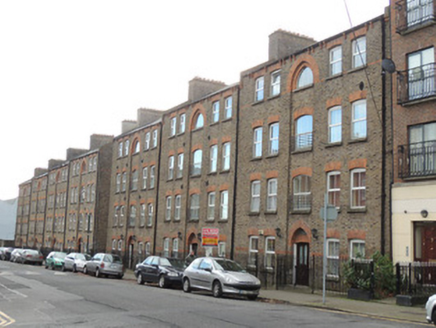 Temple BuildingsApartment/flat (purpose-built) · 73 yd
 King's Inns ParkVisitor information · 103 yd
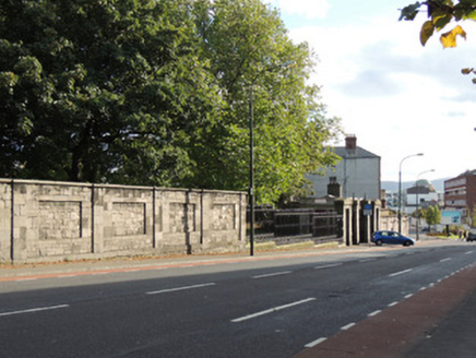 King's InnsGates/railings/walls · 109 yd
 14 Henrietta Street museumMuseum · 276 yd
 Hungry TreeHeritage attraction · 277 yd
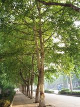 London Plane282 yd
 Chinese Toon481 yd
_-_20190904133656.jpg/250px-County_Dublin_-_Croppies'_Acre_Memorial_Garden_(Dublin)_-_20190904133656.jpg "Photo: Paul Shanahan, Wikimedia Commons · CC BY-SA 4.0") Croppies Acre MemorialMemorial · 1307 yd
Croppies Acre MemorialMemorial · 1307 yd Royal BarracksBarracks · 1315 yd
 IndicatedCathedral · 1321 yd
 Burning of the Custom HouseArmed conflict · 1543 yd
More historic places in County Dublin · All of County Dublin
What do you know about this place?